Whakapapa - Tribal Registrations

He tapu te whakapapa, nā reira, mā ngā whatū whānau anake.

Whakapapa is restricted in nature and therefore belongs only to the eyes of this family.

(Authentication via registration, membership and passwords are required for full access.)

If you haven’t registered with your iwi or rūnanga, below you will find links to your registration forms.

Tribal Registrations: Please register your entire whānau, including new-born babies.

1. A link to your Ngāti Hapahapai o Ngāti Huia ki Poroutāwhao o Ngāti Raukawa ki te Tonga registration is here

2. A link to your Te Hapū o Ngāti Hapahapai registration is here

3. A link to your Ngāi Tahu registration is here

4. A link to your Awarua Rūnanga registration is here

5. A link to your Ōnuku Rūnanga registration is here

6. A link to your Ōraka-Aparima Rūnanga registration is here

7. A link to your Waihōpai Rūnanga registration is here

8. A link to your Wairewa Rūnanga Registration is here

9. A link to your Ngāti Kurī (Kaikōura Rūnanga) is here

10. A link to your Ngāti Tama Registration is here


Whakapapa Ngāi Tahu

Ancient Iwi

According to Māori oral traditions, the earliest peoples to inhabit Te Waipounamu were tribal groups known as Hāwea, Rapuwai, and Waitaha, who inhabited the island for centuries before the arrival of more recent tribal migrations of Ngāti Māmoe, Ngāti Wairaki, and Ngāi Tahu. The early moa hunting tribes are believed to have been established in Canterbury about one thousand years ago.

Hāwea

Today, little is known of the traditions of Hāwea and where they originated from.

It is said that they were the first tribe to settle on the South Island. Chief Taiehu and his axe was Āwhioraki.  Waka: Kapakitua. A very dark people with thick, curly hair and strong white teeth.

Tipuna: Hawea-i-te-raki, the son of the chief Waitaha-Ariki (p. 21; Traditions and Legends of Southern Māori, J Beattie.)

Te Rapuwai / Rapuai / Ngā ai Tanga a te Puhirere / Te Mano o te Rapuwai

Originally from the North Island, the second tribe to settle in the South Island. Copper and ginger-coloured hair, but of Polynesian descent.

Their history and traditions have not persisted, and it is believed that over time they were readily absorbed into Waitaha.

The Rapuwai people lived at the head of the Ōhou lake in Canterbury.  One of the districts they most densely populated is about Lake Kaitangata, in the Otago Province, and that district is sometimes called, in consequence, “Te Mano-o-te-Rapuwai.” One of their most populous villages was Te Ika-maru, which is said to have been named after a great chief. A sub-tribe of Rapuwai is said to have been Kāti-koko, and an interesting legend is told of these people. They went round to the Sounds, found a huge piece of greenstone in the sea, and set out to drive it round to the Bluff. Three canoes followed it—one on each side and one behind—and yet it nearly eluded them several times. They nearly got it ashore at Ōraka (five miles west of Riverton), but it dodged on till it settled where it is, and it now forms Motupiu (Dog Island, off the Bluff).

Hapu: Kāti Koko

Waitaha / Te Kapuwai

It is known that the more recent tribal grouping of Waitaha originated from the east coast of the North Island. Major Waitaha settlements in Canterbury were established at Puari Pā and at Pegasus Bay.

Recent excavations have been carried out at the site of a new township called Pegasus, which has been built near the Ashley (Rakahuri) River. The archaeological work carried out has revealed an extensive site believed to be 500–600 years old. Hundreds of artefacts have been found, including numerous pounamu items, which indicate that this area was a significant pounamu working site over a long period of time. This Waitaha pā is close to Kaiapoi pā, the home of the Ngāi Tūāhuriri chief Tūrākautahi.

Today, Waitaha traditions remain an integral part of Te Waipounamu through the names given to geographical features, rivers, and coastlines of this large island by these inhabitants.

They were the third tribe to settle on the South Island between 1477 and 1577.  They also had Pā at the mouth of the Molyneux River, Lake Te Anau, Lake Wakatipu, and Ōamaru.

Ōtaraia bears the name of a Waitaha chief. Waiwera is named after Waiwhero, a Waitaha Chief. Te Anau and Aparima after chieftainesses.

Not was not as dark-skinned as Hāwea and had long, straight hair.

Waka: Uruao, also known as Te Waka a Rangi

Hapū: Kāti Rākai

Chief: Rākaihautū

Kāti Māmoe / Hotu Māmoe

The fourth tribe to settle in the South Island occurred in 1577–1677,  prior to Kāi Tahu conquering all previous iwi.

Hapū: Kāti Rākai, Kāti Hinekato (Edward Shortland)

Other ancient Iwi

This information is from The Oral Traditions of Ngāi Tahu page 17.

Ngāti Wairaki

Ngāti Tūatakōkiri

This information is taken from Tikao Talks.

Kahea: is an ancient tribe that perhaps Māmoe and Waitaha are offshoots of. Taare Tikao mentions that Te Maiharoa was a descendant of Kahea.

Kāti Matamata pg. 42 Tikao Talks. It is briefly mentioned that one person may be living at Port Levy and one in Tuahiwi. pg. 405 of Traditional Lifeways of the Southern Maori by Herries Beattie states the likely whānau of Kāti Matamata

Kāhui Tipua: The first inhabitants of the south island were said to be giant ogre-like people. They were a hapū of the Maeroero Iwi. Tipuna: Tara. Rapuwai conquered them.

Kāti Ira: near the top of the South Island.

Kui: An ancient race so denominated; they are said to have been a people of short stature who inhabited New Zealand after Maui visited it. Page 42, Māori Place Names of Canterbury. H.Beattie.

Maeroero / Maeroero-Rapuwai: lived in the bush and would fish with their finger nails in the shallow bays. They would warn Māori not to come too close. They played their flutes near Akaroa. Descendants of Rapuwai lived on the Banks Peninsula until the arrival of the Pākehā.

Māoriori: According to Taare Tikao, this Iwi was in the South Island for about 100 generations before Hāwea. There were two hapu of this tribe called Kui, Kae, and Tutumaiao.

Patupairehe: They would play their flutes, and their flashing lights could be seen on the mudflaps. They lived on the Banks Pensinsula until the arrival of the Pākehā.

Pounemu were an ancient tribe who fled Hawaiki from two other tribes, Hoaka (grindstone) and Mata (flint). All three tribes were in the South Island. Pounemu waka is the Tairea. Hoaka and Mata iwi came in the Āraiteuru waka.

Tini-o-te-para-rakau the iwi of Wahie-roa, the father of Rata.

Kāti Raka (pg 21 Traditions and Legends of Southern Māori J Beattie.)

Pohatu-Parimurimu (pg 21 Traditions and Legends of Southern Māori J Beattie.)

Te Aruhe-Taratara (pg 21 Traditions and Legends of Southern Māori J Beattie.)

Te Raupō-Manu (pg 21 Traditions and Legends of Southern Māori, J Beattie.)

Te Rākau-Tipu (pg 21 Traditions and Legends of Southern Māori J Beattie.)

Te Rākau-Hape (pg 21 Traditions and Legends of Southern Māori J Beattie.)

Kāhui Roko; Hapū: Roko tuatahi, Roko-i-tua, Roko-i-pae, Roko-i-te-aniwaaniwa, Roko-i-he-haeata. Chief: O-roko-i-te-ata (pg 21 Traditions and Legends of Southern Māori J Beattie.)
 
Ngāi Tahu Hapū

Within Ngāi Tahu there are now five primary hapū: Kāti Kurī, Ngāti Irakehu, Kāti Huirapa, Ngāi Tūāhuriri and Ngāi Te Ruahikihiki.

Below is a list of some of the traditional (or pre-settlement) hapū names of Kāi Tahu.

Hāwea
Hinekura (Kaikōura)
Kāi Tara
Kāi Kahukura/Kai Te Kahukura (Tuahiwi)
Kāi Tangata
Kāi Taoka
Kāi Tarawa
Kāi Tarewa (Akaroa)
Kāi Te Aotaumarewa
Kai Te Atawhuia (Kaiapoi)
Kāi Te Makahi
Kāi Te Pahi
Kāi Te Raki
Kāi Te Rakiamoa
Kāi Te Rangi
Kāi Te Rangitamau
Kāi Te Urupaoa
Kāi Tūāhuriuri
Kāi Tuaki
Kāi Tūhaitara
Kāi Tuke
Kāi Tuna
Kāi Tūteahurewa
Kāti Hapūiti (pp. 93 and 94, Canterbury Place Names)
Kāti Hāteatea
Kāti Hāwea
Kāti Hikawaikura

Kāti Hikoa

Kāti Hikoata
Kāti Hinekakau
Kāti Hinekato
Kāti Hine Kura (Kaikōura)
Kāti Hine Matua (Bluff)
Kāti Hinemihi
Kāti Hinetewai (Half Moon Bay)
Kāti Huikai
Kāti Huirapa
Kāti Ira


Kāti Irakehu/Kāti Irekehu (Banks Peninsula)
Rongokako
Kāti Kane (Country from the Waitaki south to Shag Point and inland to Lakes Hāwea and Wānaka)
Kāti Karehu
Kāti Kaweriri
Kāti Kopihi
Kāti Koreha (Their old pā stood back on the old coach road north of the Ahuriri Lagoon.)
Kāti Kuia
Kāti Kura
Kāti Kurī
Kāti Kūware
Kāti Māhaki
Kāti Makō
Kāti Māmoe
Kāti Matamata (Kāti Māmoe)
Kāti Mihi
Kāti Moki (Taumutu)         

Kāti Mū
Kāti Pahi
Kāti Rahui
Kāti Rakaihautu / Kāti Rakai
Kāti Rakaimamoe
Kāti Raki (pp. 93 and 94, Canterbury Place Names)
Kāti Rakiāmoa
Kāti Rakiwhakaputa
Kāti Rokomai
Kāti Ruahikihiki
Kāti Tahupōtiki
Kāti Tairewa
Kāti Tamahaki

Kāti Te Aohikuraki
Kāti Te Atawhiua
Kāti Te Rakiāmoa
Kāti Tepaihi
Kāti Tū
Kāti Tūahuriri (Tuahiwi)
Kāti Turakautahi
Kāti Tuteahuka (Kāiapoi)
Kāti Urihia
Kāti Waewae (West Coast)
Kāti Wairaki (West Coast)
Kāti Wairua
Kāti Wakakaha
Kāti Whae
Kāti Whaea
Kāti Whaitara
Kāti Wheke (Rāpaki)
Kāti-Tumatakōkiri
Taupōnui
Tura
Te Ahuriri
Te Aitaka a Tapuiti
Te Ana o Kātiwairua (Māmoe Hapū)
Te Ataumarewa
Te Au Taumarewa (Moeraki)
Te Rakiwhakaputa
Tuteuhuka
Uenuku
Kāti Whata (Waimea)
Kāti Rua (Waimea)
Kāti Ruatapu (West Coast)
Kāti Kawerirī
Ngāi te Aotaumarewa
Poupoutunoa (Canterbury)
Kāti Rakiora (Canterbury)
Ko Ngāi-te-rua-wai (pp. 93 and 94, Canterbry Place Names)
Ko Ngāti Hinewairaki (pp. 93 and 94, Canterbry Place Names)
Ko Ngāti-paro-paro (pp. 93 and 94, Canterbry Place Names)
Ngāti Kaweriri (pp. 93 and 94, Canterbry Place Names)Kāti-paroparo near Cave in Orari hills (Canterbury Place Names pg 114, A mixed Waitaha-Kāti Māmoe)

 
Ngāi Tahu – Who We Are

Ngāi Tahu means “people of Tahu” and all Ngāi Tahu whānui can trace their ancestry back to this man, the tribe’s founder, Tahu Pōtiki.

Our defining link as Ngāi Tahu is the ability to whakapapa back through this history and link with our ancestors of the past. This brief history gives an overview of where we come from which hopefully does not diminish the rich tapestry that is our history.

Ngāi Tahu are the Māori people of the southern islands of New Zealand—Te Waipounamu – the Greenstone Isle. We hold the rangatiratanga or tribal authority to over 80 per cent of the South Island. Our histories begin as with all Māori when the first settlers of Polynesia colonised Tonga, from the west, about 1500 BC. Over the next 2000 years their descendents colonised the remainder of Polynesia, starting with Samoa, then moving on to the Marquesas (about 2000 years ago), Tahiti (1500 years ago) then on to Easter Island, Hawaii, New Zealand and the Chathams. They found New Zealand uninhabited but full of wonderful new food sources. Some of the features typical of this period are moa-hunting and sea-mammal hunting economy, supplemented by crops of root vegetables.

Archaeology reveals that settlements were predominantly coastal, probably for the proximity to their major food source, the ocean. As a result of population pressure about 500 – 800 years ago, settlements became more widespread and regional differences began to appear perhaps relating to the development of different tribal groups. The first real evidence of tribal warfare comes from this period with the appearance of various weapons and the construction of fortified pā sites (settlements).

The Ngāi Tahu people have their origins in three main streams of migration. The first of our people to arrive in the southern islands migrated here under the leadership of Rākaihautū on the waka (canoe) Uruao. They arrived in Whakatū, Nelson and proceeded to explore and inhabit the South Island. This is the origin of the Waitaha iwi, who named the land and the coast that borders it.

The plentiful resources of Te Waipounamu called others to abandon their northern homes and move southward. The second wave of migration was undertaken by the descendants of Whatu Māmoe who came down from the North Island’s east coast to claim a place for themselves in the south. These descendants came to be known as Kāti Māmoe and through inter-marriage and conquest these migrants merged with the resident Waitaha and took over authority of Te Waipounamu.

Continuing the link with the east coast of the North Island, Paikea landed in the Bay of Plenty and fathered Tahu Pōtiki.

The descendants of Tahu Pōtiki who formed Ngāi Tūhaitara and Ngāti Kurī moved south travelling first to Wellington. Ngāi Tūhaitara and Ngāti Kurī settled in Te Whanganui-a-Tara (Wellington) under the respective leadership of Tū Āhuriri and Maru Kaitātea.

Ngāti Kurī and Ngāi Tūhaitara migrated to Te Waipounamu. Maru Kaitātea established Ngāti Kurī at Kaikōura. Tūāhuriri’s son, Tūrākautahi, placed Ngāi Tūhaitara at Kaiapoi Pā. With Kaikōura and Kaiapoi Pā established, and through intermarriage, warfare and political alliances, Ngāi Tahu interests amalgamated with Ngāti Māmoe and Waitaha iwi and Ngāi Tahu iwi established manawhenua or pre-eminence in the South Island. Sub-tribes or hapū became established around distinct areas, and have become the Papatipu Rūnanga that modern day Ngāi Tahu use to exercise tribal democracy.

Pēpeha – Tribal Proverb / Sayings

Ko Aoraki te waka Atua – Aoaraki is the godly canoe

Ko Uruao te waka Tipua – Uruao the supernatural canoe

Ko Kurahaupo te waka takata o taku rahi – Kurahaupo the canoe of our people and importance

Whatoka ki te ihu, ruatea ki te riu, popoto taku tipuna ki te uruki e! – Whatoka at the bow, Ruatea at the hull, my ancestor Popoto navigates!

_______________________

“Mō tātou, ā, mō kā uri ā muri ake nei…” For us and our children after us…
 
Whakataukī Ngāi Tahu – Ngāi Tahu Proverbs


1.Huriawa Karamea, Huirapa Kōkōwai, He kura huna ko karo Kāhore ia, Kāhore ia hī.

The clay from Huriawa preserves our ancestral house. Will our knowledge be lost, Never! Never!

2. Ko ō mātou kāinga nohoanga, ko ā mātou mahinga kai, me waiho mārie mō ā mātou tamariki, mō muri iho i a mātou.

Our places of residence, cultivations and food-gathering places must still be left to us, for ourselves and our children after us. Kemps Deed.

3. Ko te toa i a tini i a mano o te tangata”

Tūwhakauika & Te Oreorehua – We possess the strength of the many. It is the bravery of a multitude, of thousands of people.

4. Hāhā te whenua, hāhā te tangata.

Desolate land, desolate people.

5. He mahi kai takata, he mahi kai hōaka.

It is work that consumes people, as greenstone consumes sandstone.

6. He manawa tahi, he manawa ora, he manawa toa, te manawa Kāi Tahu.

A united heart, a vibrant heart, a determined heart, this is the heart of Kāi Tahu.

7. Kauraka koutou i mate pīrau pēnei me au nei. E kāore! Me haere ake koutou i ruka i te umu kakara. Taku whakaaro i mate rakatira i ruka i te tāpapa whawhai.

Do not die a rotting death like mine. No! Leave this world via the fragrant ovens of war. In my opinion a chiefly death occurs on the battlefield. On his deathbed, Te Wera, a renowned Kāi Tahu fighting chief, warned his sons to die honourably on the battlefield and not slowly of natural causes, as was his fate.

8. Kei korā wā kei Motupōhue, he pāreka e kai ana, nā tō tūtae.

It was there at Motupōhue that a shag stood, eating your excrement.

9. Kia pai ai taku titiro ki Te Ara a Kiwa.

Let me gaze upon Foveaux Strait.

10. Ko ngā hau ki ētahi wāhi, ko ngā kai ki Orariki.

Whatever the season or wind, food will be found at Orariki.

11. Ko te kāhui mauka, tū tonu, tū tonu, ko te kāhui takata karo noa, karo noa ka haere.

The people will perish but the mountains shall remain.

12. Te kopa iti a Raureka.

The tiny purse of Raureka. This refers to a female ancestor, Raureka, who travelled from the West Coast in pursuit of a lost dog. She encountered people in the South Canterbury region and took from her purse the pounamu, or greenstone. This pepeha is used to denote something precious.

13. Ko te mauka ko Te Whatarama, te manu o reira, he kākāpō. Mōku tēnā mauka kia maro ai a Hine-mihi rāua ko Hutika.

Te Whatarama is the mountain of parrot and will be mine to cloak my daughter Hinemihi and Hutika.

14. Takaroa pūkunohi nui.

The god of the sea Takaroa can observe all we are doing.

15. Te Puna Waimarie, Te Puna Hauaitu, Te Puna Karikari.

The pools of frozen water; The pools of bounty; The pools dug by the hand of man. On arrival in this new land, Rākaihautu sought an indication of the nature of the land and the fortunes that awaited him and his people. With his digging stick he made three pools and then gave the prophetic utterance about what lay before them.

16. Tūrākautahi: Ko Kura-tāwhiti te mauka kākāpō, ko au te takata.

Kura-tāwhiti is the mountain that has the parrot and I am the man.

17. E tā mā, haramai rā, kia komotia ō koutou ihu ki roto i Taratu.

Come here sirs, and we’ll bury your noses in Lake Taratu. This was the challenge of Ngāi Tahu at Kaiapoi as Te Rauparaha was trying to breach the pā’s defenses. The metaphor of the nose being submerged or above water is stiff current. Above water is taken to mean survival and progress; below water is suffering death. (Ngā Pēpeha a ngā Tīpuna).

18. Haere e oma kia puta ai koe.

Go, run in order that you may escape.
The saying comes from the story of Tūāhuriri. He ordered the ambush of people from Kaikōura. When the people of Moeraki heard of this, they sent a war party to take revenge who entered the village of Tūāhuriri and took the people prisoner. Kūwhare was held apart by order of a young chief to be killed by him, but was able to escape but was perused by a noted runner. The runner called out to him the above, which is now the whakataukī. (Ngā Pepeha a ngā Tipuna: White 1887: III.111)

19. Haere, e te hoa, ko tō tātou kāinga nui tēnā.

Go, o friend, for that is the great abode for us. A poetic farewell fitting for the funeral obsequies. (Ngā Pēpeha a ngā Tīpuna: Davis 1974: 58)

20. Haere mai, e te Rāwhiti.

Welcome o sunrise. A traditional greeting of the South Island to the North Island.
A reference to the fact that each day the sun first reaches Hikurangi. (Ngā Pēpeha a ngā Tīpuna: Smith 1913a:113)

21. Te Whakatakanga o te Ngārehu a Tamatea.

The preparation of Tamatea’s charcoal.
This allusion to the tattooing of Tamatea was used by Kāi Tahu when referring to the people of Murihiku. (Ngā Pēpeha a ngā Tīpuna: Anderson 1942:183; Cowan 1905: 195).

22. He Puna Hauaitu; He Puna Waimaria; He Puna Karikari a Rākaihautu.

The pools of frozen water; The pools of bounty; The pools dug by Rākaihautu (Te Kete Ako a Rākaihautu).

23. Hakahaka Te Raki i ruka nei, ko te po koua tupu.

Though the heavens hang low there is growth in the dark. Two Ngāi Tahu chiefs whose tribe faced annihilation used this phrase. Also appears at the start of Ngāi Tahu whakapapa to the creation chants, which indicates that from darkness life emerged. (Ngā Pikitūroa o Ngāi Tahu. The Oral Traditions of Ngāi Tahu. (Ngā Pikitūroa o Ngāi Tahu: Page 79.)

24. Tokotoru a te tuakana, tokotoru a te taina, ko ngā tokoono ēnei a Hemo i noho ai i Tūranga.

‘Hemo the mother of Ngāti Porou and Ngāi Tahu – all who came from Tūranga. (Christchurch City Libraries, ‘Tūranga – Our Māori name’).

25. Te Whatu-Kura a Takaroa.

A flattering and figurative allusion to a high-born girl. (Tikao Talks: page 28).

26. Ko mate te marama. A saying when the moon disappears away. (Tikao Talks: Page 44).

27. Ka tō te rā. The sun is setting. (Tikao Talks: Page 46)

28. Ngā rā o Toru Whitu.

The sun from July to November (Tikao Talks: Page 46).

29. Ko tō te rā.

The sun has set (Tikao Talks: Page 46).

30. Whatutaki te marama ki te rā.

Reference to an eclipse of the sun. (Tikao Talks: Page 48).

31. Ko te kete ika a Tutekawa.

A reference to the large amount of fish in Lake Forsyth and Lake Waihora/Ellesmere. (Tikao Talks: Page 129).

32. Te hauka te ahi.

A reference to a stranger who stays longer will get to know the hosts better. (Tikao Talks: Page 152).

33. O te parara.

A derogatory term for a Māori person of mixed descent. The saying implies the person’s mother was paid for intercourse that produced the offspring. (Tikao Talks: Page 155).

34. Ko Waitaha kua Ngāti Māmoetia, kua Ngāi Tahutia.

(Waitaha were absorbed by Ngāti Māmoe who were in turn absorbed into Ngāi Tahu).

35. Te kōkopu, te kai o Maui.

The kōkopu, the food of Maui. pg 10 Moriori : the Morioris of the South Island by Herries Beattie

36. Te hao te kai a te aitaka a Tapu-iti.

That the small delicious eel known as hao is the favourite food of the descendants of Tapu-iti, who was the wife of Te Rakihouia. pg 32 Moriori : the Morioris of the South Island by Herries Beattie

37. Ka-poupou-a-Te Rakihouia.

The whole Canterbury seaboard is known as. Lit. the posts of Te Rakihouia. Because that chief erected posts at the river-mouths to enable eel weirs to be built. g 32 Moriori : the Morioris of the South Island by Herries Beattie

38. Ka-whata-kai-a-Te Rakihouia.

The sea cliffs along the east coast. Lit. the food storehouses of Te Rakihouia. pg 32 Moriori : the Morioris of the South Island by Herries Beattie.

39. Whata-tū-a-Te Rakihouia.

The sea cliffs along the east coast. Lit. the standing storehouses of Te Rakihouia. Because the son of Rākaihaitū procured food from them. pg 32 Moriori : the Morioris of the South Island by Herries Beattie.
 
Rakiura – Stewart Island

Rakiura ‘glowing skies’

It was named this after ‘Tahu-nui-a-rangi’ or ‘Ngā Kurakura o Hinenuitepō’ the ‘southern lights’ or ‘aurora australis’.

It it also know by other names:

Motunui ‘big island’

Te Punga o te Waka o Māui ‘the anchor of the waka of Māui’

Stewart Island to Pākehā

At 1,680 km2, it is our thirs largest island.

Halfmoon Bay on the north-east coast is 39km from Bluff. 

Te Ara a Kiwa – Foveaux Strait

Kiwa’s pathway and Kewa’s lost tooth

Māori knew Foveaux Strait as Te Ara a Kiwa (the pathway of Kiwa). Kiwa was an ancestor who tired of crossing the isthmus which, according to the story, then connected Rakiura to Southland. He asked the whale, Kewa, to eat through the land to create a channel so Kiwa could cross by waka. Crumbs that fell from the whale’s mouth became islands in Foveaux Strait. Solander Island (Hautere), which guards the western approaches of the strait, was also known as Te Niho a Kewa, a tooth lost from the whale’s mouth.

Ngāi Tahu Pēpeha
 

Below is a list of all Ngāi Tahu Papatipu Rūnanga Pēpeha.

I have included them all so you can begin to see the connections between Ngāi Tahu whānau whānui and our Ngāi Tahu whanaunga.

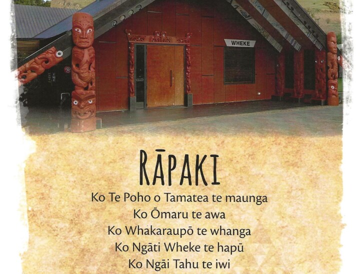
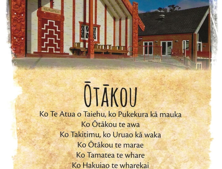
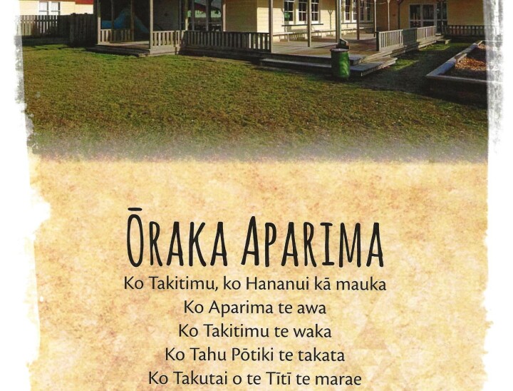
The six in which we as a whānau, have the strongest whakapapa connections with are:

* Awarua

* Ōraka Aparima

* Waihōpai

* Wairewa

* Ōnuku

* Kaikōura

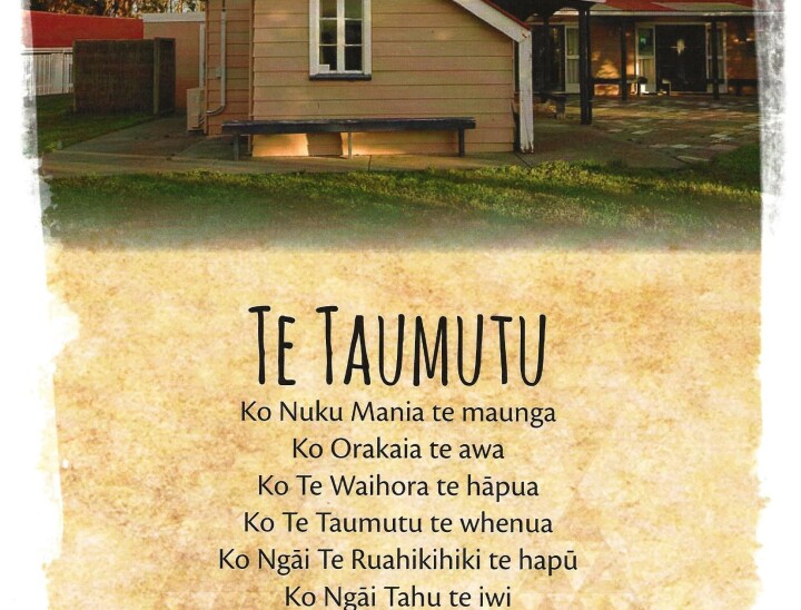
And then of course there is Te Taumutu where we have a lot of our tīpuna at this urupā including Nanny Hinewai Thomas and her parents, Charles Morgan Thomas and our Kuia (Hinewai’s Mother) Te Amo May Epiha from our Ngāti Huia side.

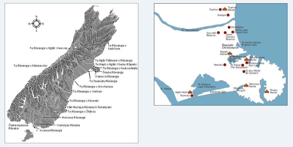
The map below (L) hand side, show the location of all 18 Papatipu Rūnanga, whilst the map (R) hand side shows the location of two of our marae, those being Wairewa and Ōnuku, it also shows Ngāti Moki marae at Te Taumutu where Nanny Hinewai mā lay in the urupā.
Our Present Kāi Tahu Rūnaku Affiliations - Ōnuku

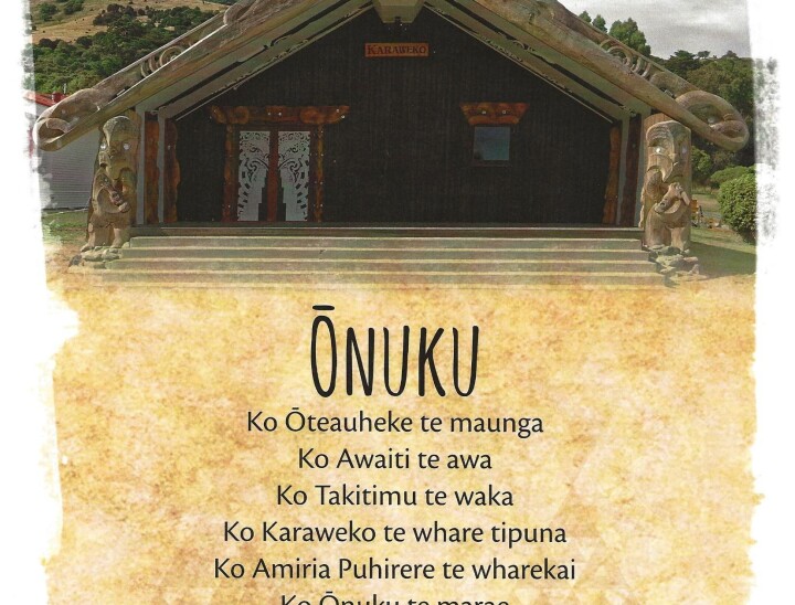
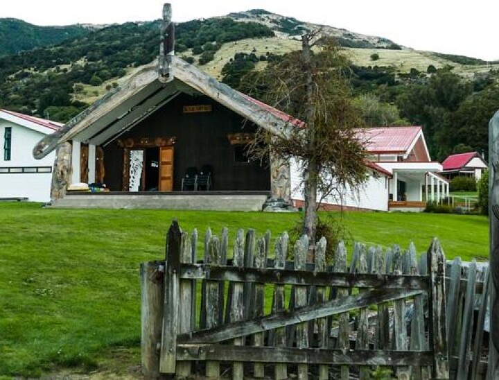
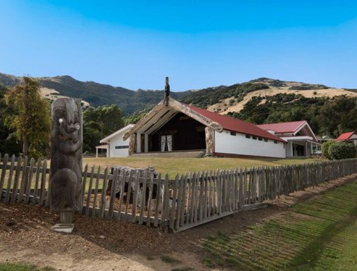
Ōnuku Marae is a five-kilometer meandering drive from the Akaroa township towards the heads of Akaroa Harbour. The marae emerges suddenly at the roadside, glimpsed through a fringe of harakeke. The craggy peak Ōteauheke rises up behind the marae that sits at an angle to the lapping shoreline of the harbour. Ōnuku Marae is home to the hapū of Ngāi Tarewa and Ngāti Irakēhu. Irakēhu was the mother of many of the hapū and pā in the Horomaka (Banks Peninsula) area.
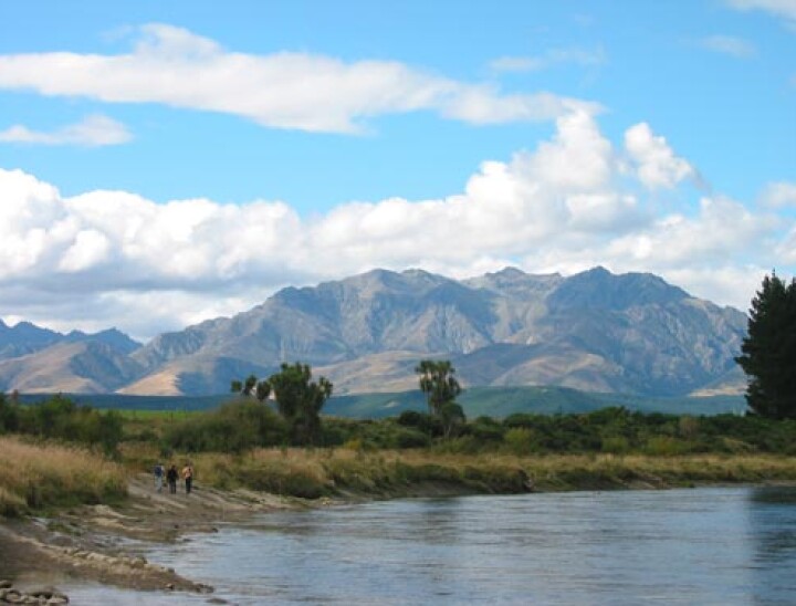
Aspects of the land around Ōnuku Marae

Akaroa harbour is of great significance as a mahinga kai – its waters traditionally provided the primary sustenance for the people of Ōnuku. The rim of hills and peaks that look down upon Akaroa’s waters evoke many important histories. Directly across the harbour from Ōnuku Marae stands the distinctive Tuhiraki (Mt Bossu). This peak is said to have been formed when the Ngāi Tahu explorer Rākaihautū thrust his kō (digging stick) into Horomaka after using it to dig out all the principal lakes of Te Wai Pounamu including nearby Te Roto o Wairewa and Te Waihora.

At the shallow head of the harbour between Barry’s Bay and Duvauchelle lies the once fortified Ngāi Tahu pā, Ōnawe. The distinctive whale-shaped peninsula that juts out into the water was the site of a bloody massacre when it was invaded by the Ngāti Toa chief, Te Rauparaha in 1832. The Ngāi Tahu fighting chief Tāngatahara led the unsuccessful defence of Ōnawe but later helped to drive Te Rauparaha from the South Island.

Te Tiriti o Waitangi

Ōnuku is a place of historical significance as the first of the three locations (the others being Ōtakou and Ruapuke) in the South Island where Te Tiriti o Waitangi was signed. Two local chiefs, Iwikau and John Love (Hone) Tikao signed the Treaty at Ōnuku. Ōnuku Marae was fittingly, the site where in 1998, the then Prime Minister Jenny Shipley presented the Crown Apology to Ngāi Tahu – the final stage in the settlement of Te Kerēme (the Ngāi Tahu Claim).

Takapūneke (Red House Bay) which lies between Akaroa and Ōnuku is a place of immense significance in the story of Te Tiriti.  Takapūneke was the home of the Ngāi Tahu Upoko Ariki (Paramount Chief) Te Maiharanui. On 6 November 1830, Te Rauparaha captured Te Maiharanui by deception and then raided and destroyed his kāinga at Takapūneke. Te Rauparaha was aided by a British ship’s captain, Captain Stewart of the Brig Elizabeth.

When British authorities learned of Stewart’s involvement in the massacre at Takapūneke they were appalled at the anarchic state of affairs in New Zealand. As a direct result of British concern at the Takapūneke incident, James Busby was sent to New Zealand as ‘British Resident’ in 1833. Thus began the British intervention that would culminate in the signing of Te Tiriti o Waitangi seven years later.

Māori and Pākehā at Ōnuku & effects of the loss of the land

Takapūneke was a centre for trade between Māori and visiting Europeans in the earliest days of European contact. In the 1800s, whalers and other traders visited Akaroa to replenish necessary supplies, especially food. Much of the land was cultivated in farmland and there was trade in timber, food and flax. Following Te Rauparaha’s attacks on Takapūneke and later Ōnawe, survivors sought refuge at Ōnuku and cultivated the land there.

French settlement of the Akaroa area and the later claiming of the land by the English had devastating consequences for local Māori. Confiscation of their lands removed their ability to cultivate food and thus to trade. Māori had no option but to take jobs working for the newly arrived European settlers who were establishing farms on what had been Māori land.

Confiscated lands

Some Ōnuku Māori still do not believe that they have been duly compensated for the mass appropriation of their lands. Court action in the mid 1800s led to a Native Reserve being set aside at Ōnuku in 1856. Lands were also returned at Ōpukutahi on the opposite side of the harbour near Wainui. The returning of lands at locations some distance from the Akaroa centre seemed a deliberate act to keep Māori away from the primary area of European settlement this, despite the fact that the entire Akaroa area had once belonged to Māori. European farmers owned the other adjacent lands at Ōnuku and by the late 19th century, over 100 people Māori and Pākehā lived there. At this time, Ōnuku had become the most important Māori kāinga on the Akaroa side of the harbour. Māori and Pākehā have lived alongside each other in the Ōnuku area for over 150 years.

Amiria Puhirere and Karaweko

Building the wharekai, Amiria Puhirere:
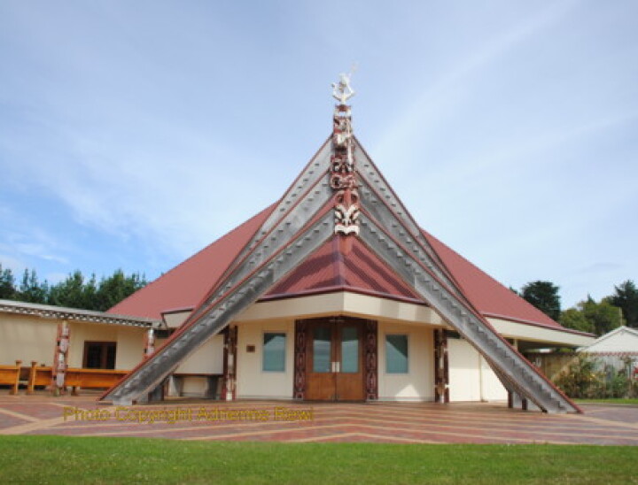
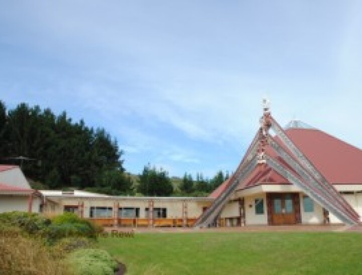
A wharekai was built at Ōnuku and officially opened in 1990 during Centenary celebrations of the signing of Te Tiriti o Waitangi. For Henare Robinson (who was the head of Ōnuku Rūnanga at that time) and many others, the opening of the wharekai was the beginning of the fulfillment of a dream to build a whare tūpuna at Ōnuku. Robinson named the wharekai after the inspirational taua, Amiria Puhirere who was loved and admired by generations of Ōnuku whānau. Amiria Puhirere was the daughter of Mere Whariu and Karaweko. She was over 100 years old when she died in 1944.

Building the wharenui, Karaweko:
The wharekai provided a place for whānau visiting Ōnuku to come together but the empty space adjacent to it beckoned to be filled – soon plans were underway for the building of the wharenui…

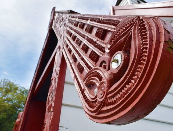
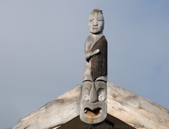
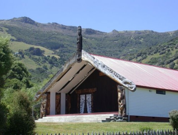
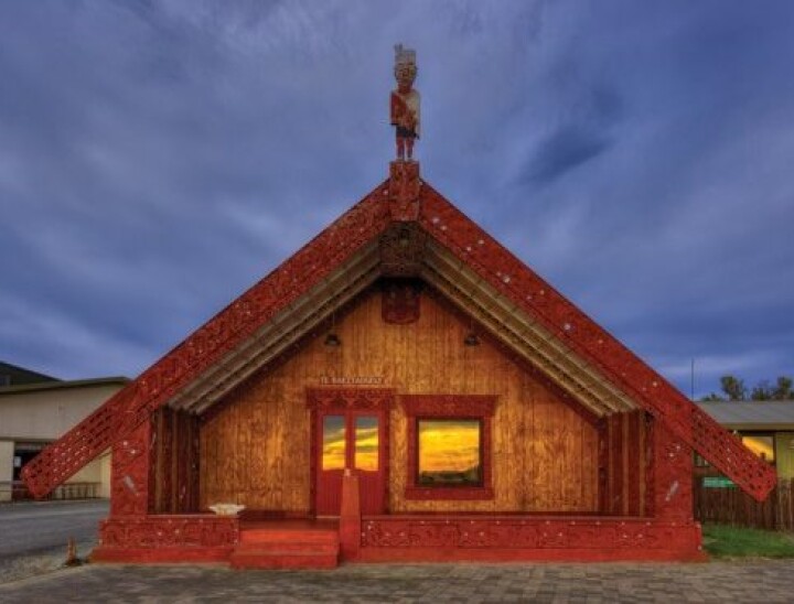
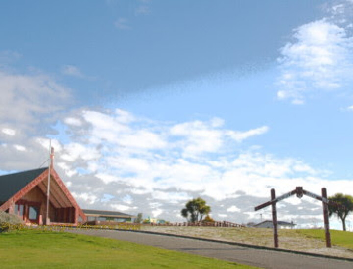
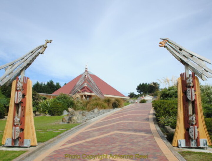
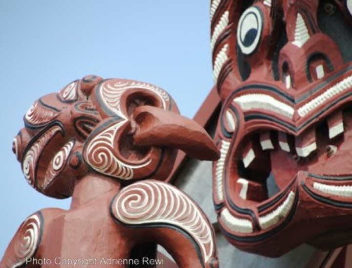
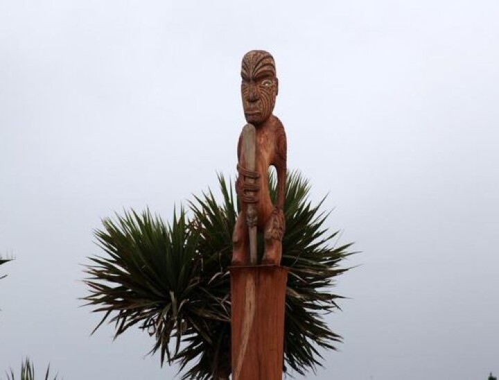
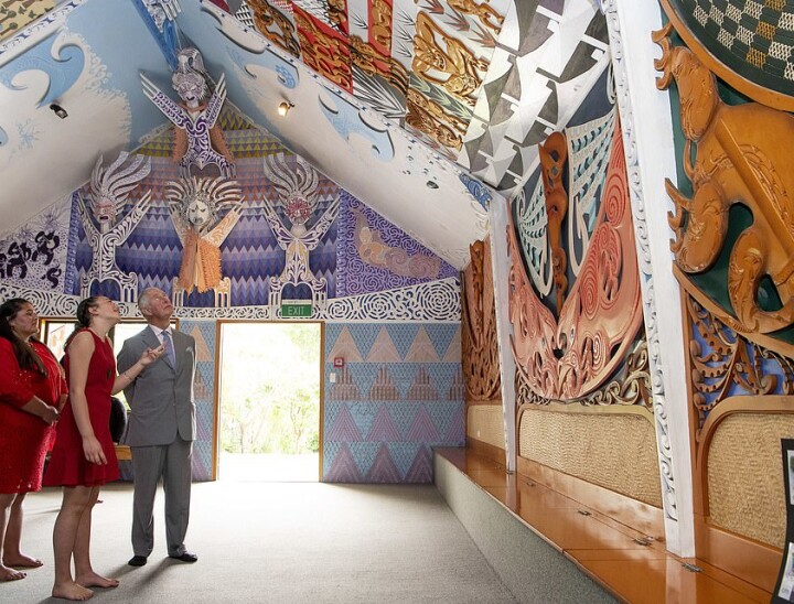
A carving committee led by Pere Tainui was set up to research the whakapapa and history which would be represented in the whakairo of the house. Master carver Eric Korewha of Ngā Puhi was commissioned by Ōnuku Rūnanga to carve the wharenui. Carvers Simon Rogers, Hono Fleming, Hone Taiapa and Carl Wards worked with Korewha to craft whakairo out of West Coast Tōtara. Four years were spent on the project and every Māori of Ngāi Tahu descent can trace their ancestry to the tūpuna represented in the carvings. The Ngāi Tahu paramount chief Te Maiharanui is the tekoteko standing atop the house with shining eyes. His wife Te Whe and daughter Roimata are represented in the pare sited at the entrance to the house, a traditional place for leading women of the tribe to be displayed.

Ngāi Tahu weaver Cath Brown of Taumutu led a core group of weavers from Ōnuku and many other marae in making the tukutuku panels for the interior of the house. The hues of the tukutuku – olive green, black and gold, mirror the colours found in the Ōnuku landscape. The pātiki (flounder) shape was chosen as the principal design feature for the work because it is the major sustainable ika (fish) of the peninsula area. Ōnuku Ngāi Tahu worked with the support of whānau from other hapū to complete panels which feature the distinct colours and symbols of each contributing marae.

The whare tūpuna was blessed and opened at dawn on February 5 1997. A Treaty Festival took place over the following days in commemoration of 157 years passing since the signing of Te Tiriti o Waitangi. The whare tūpuna was named Karaweko after the Ngāi Tarewa chief. As a youth, Karaweko was among those taken prisoner by Te Rauparaha at Takapūneke. Karaweko later returned to the peninsula to take up his role as chief of Ōnuku. ‘Big William’ as he was known became well known as a builder of waka.

Etchings completed by Meryon a French artist show the existence of a wharenui and pātaka (storehouse) in the Akaroa area in the past. Today, Karaweko is the only fully carved whare tūpuna on Horomaka and the first carved house to be built in the area for over a hundred years.

Te Whare Karakia o Ōnuku & its opening in 1878

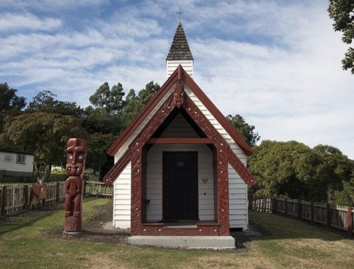
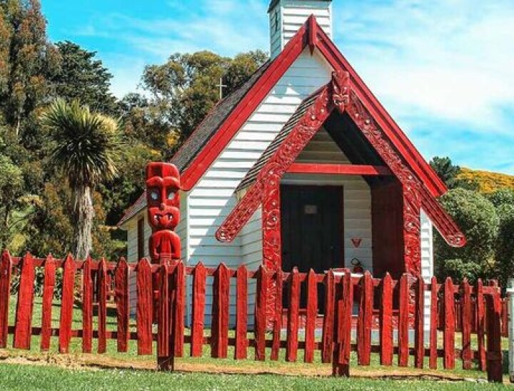
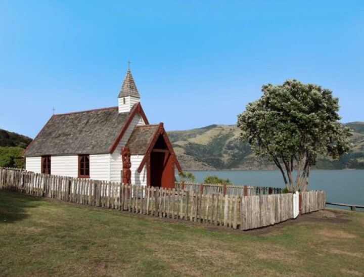
Across the road from the marae, the red and white historic Whare Karakia o Ōnuku gleams against the green hillside and harbour. The foundation stone for the whare Karakia was laid in 1876 and the building officially opened in 1878 as the first non-denominational church in New Zealand. The opening was attended by many including Māori from iwi all over New Zealand. Intended as a place of worship for Māori and Pākehā, the church drew the two communities together.

In 1939 the whare Karakia was restored to its original state in time for an Akaroa Centenary Service in 1940 that was attended by over 1000 people. A new fence was erected in 1976, and in 1997 the poupou Tumuki was placed at the side of the church. Tumuki was a koha from Te Wai Pounamu Old Girls Association and was carved by Pere Tainui.

Native School

A Native school was built at Ōnuku in 1880 that was to be the place of learning for successive generations of Ōnuku whānau. Although the school buildings no longer exist, the school house survives today and is now privately owned.

Ōnuku Marae Today

Ōnuku Marae is the marae of Ōnuku Rūnanga, one of the five Papatipu Rūnanga of Te Rūnanga o Ngāi Tahu located on Horomaka. The takiwā of Ōnuku Rūnanga is centred on Ōnuku and extends to the hills and coasts of Akaroa and the peninsula where it adjoins the nearby rūnanga of Te Rūnanga o Koukourārata and Wairewa Rūnanga. Today the marae is booked for use for eight to nine months of the year. Its peaceful location and idyllic surroundings away from the city make it ideal for meetings and conferences. Every second weekend the marae is reserved for use by Ōnuku whānau.

Our Present Kāi Tahu Rūnaku Affiliations - Wairewa


Ki uta he urunga mō tōku ūpoko, ki tai he tūranga mō ōku waewae.
Inland a pillow for my head and on the shores a rest for my feet.

Magnificent forest of giant Tōtara once dominated the Little River Basin that cradles Te Roto o Wairewa (Lake Forsyth). Today, small pockets of native bush and the reedy lake edge growth are small reminders of the lush forest and abundant birdlife that existed in the area until the middle of the 19th century. Little River was earlier referred to as ‘the river’ and probably derives from an English pronunciation of the Māori ‘Wai – rewa.’ Wairewa means ‘water lifted up’.

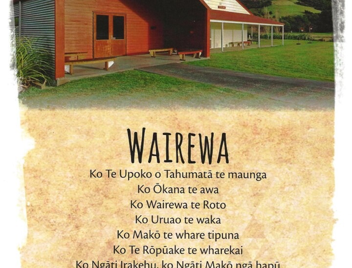
Wairewa marae is situated in the Ōkana valley on the Eastern side of Te Roto o Wairewa just past Little River on the Christchurch – Akaroa highway. It is home to the hapū of Ngāti Irakehu and Ngāti Makō. Wairewa is one of the five Ngāi Tahu Papatipu Rūnanga situated on Horomaka (Banks Peninsula).

Te Makō

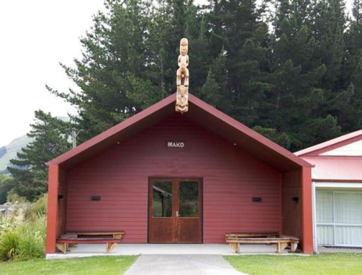
A new hall built on the footprint of the three previous whare, opened with a dawn ceremony and celebrations on 1st November 2008. Te Makō is the fourth hall to bear this name. Standing on the tāhuhu gazing out across the marae to Te Upoko o Tahumatā stands the tekoteko (carved figure) of Puraho (father of Makō) and below him the koruru (carved gable figure) of Makō. The whare Te Makō has now been refreshed and will continue to be a place of gathering for the people of Ngāti Makō and Ngāti Irakehu. For the people of Wairewa the hall represents a modern facility to take them into the 21st century.

Wairewa Marae’s original hall was opened by R Paurini in 1855. Thirty years later on 16 April 1885 a second hall was opened by H K Taiaroa on the same site. Unfortunately this hall was burnt down around the time of WWI. The third hall was erected in 1919 – 1920 and stood beside the main highway, its sunny porch facing the maunga, Te Upoko o Tahumatā until 2007, when it was dismantled to make way for the new building opened in 2008.

The History of Makō & Te Rōpūake

The new hall is still called Makō and the adjoining whare kai is Te Rōpūake. Both are named after tūpuna who descend from Tahupōtiki, the founding tupuna of Ngāi Tahu. Makō was the grandfather of Irakehu after whom the main hapū of the area takes its name. Te Rōpūake was a princess of the Ngāi Tahu people – her father was Te Rakiwhakaputa, famous for laying his rāpaki (waist mat) down on the shores of Whakaraupō (Lyttelton Harbour) thus giving the name Rāpaki to his chosen bay.

Te Rōpūake features a series of bright paintings by Paul Skipper that depict Wairewa histories.

A spotless kitchen and ablution facilities are at the back of the hall that opens onto a wide porch.

Outside, the marae is surrounded by hills. Looking down on the marae from the western side is Wairewa’s maunga, Te Upoko o Tahumatā and across the highway to the east stands Tahu Ahi (Signal Hill). Both maunga hold important histories. A small flight of steps on the marae grounds, leads up to a grassy knoll where the historic monument to Tangatahara stands surrounded by a trio of Tōtara trees.

Monument to Tangatahara

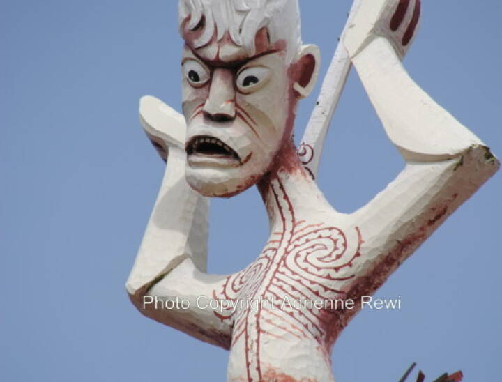
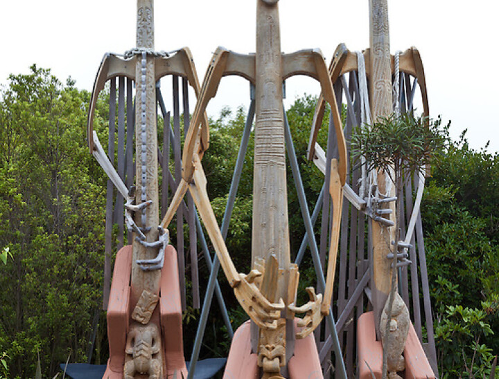
In 1900 a monument was unveiled in memory of Tangatahara a ‘great fighting chief of Ngāi Tahu’. An account of the ceremony states that “Maori… gathered in hundreds about the Maori house on a knoll, at the back of which stood the pedestal and statue of the old chief shrouded in his mat and awaiting his unveiling”, (The Press, 23 March 1900). Māori from all over the South Island attended the ceremony. A photograph recording the occasion takes pride of place above the stage inside Te Makō. The monument was carved by a French sculptor who did not know what the great chief looked like and so, based the stern facial features of the great warrior on the visage of a French aristocrat. An actual likeness of Tangatahara exists in the form of a bronze cast that is housed at the Akaroa Museum – it is remarkable that a man of such prestige allowed this cast to be made considering the required touching of his head and its tapu nature. Tangatahara led the unsuccessful defence of Ōnawe peninsula in Akaroa harbour and later helped to drive Te Rauparaha out of the South Island.

Sacred Places

Many wāhi tapu are associated with Wairewa. The hills surrounding the lake and the adjacent bays ring with histories. Tradition says that a great waka full of precious taonga was moored at the edge of Te Roto o Wairewa and covered by a landslip – the waka and its treasures remain hidden there, deep in the newly formed bank under earth and water. The earthwork remains of Ōruāka Pā are visible on the tip of the nearest spur across the lake from the main highway at the seaward end of the valley. Ōruāka was probably last occupied in the 1820s. Another Māori settlement also once existed opposite Ōruāka near Birdlings Flat. This pā was called Matahāpuka and was still occupied in the 1840s. This area later became known as Poranui.

‘Eat Relation Feud’

As with all the Māori settlements on Horomaka (Banks Peninsula), Wairewa became embroiled in the internal Ngāi Tahu warring that culminated in the Kai Huanga feud. Wairewa was the site of the first musket warfare in Canterbury and involved Wairewa Ngāi Tahu fighting against a war party from Kaiapoi Pā and a southern war party led by Taiaroa the chief from Ōtākou. The Wairewa contingent escaped onto the lake in waka but were pursued by Taiaroa and his war party. Many were killed and eaten.

Wairewa Pā

The Wairewa Pā was on the east bank of the Ōruāka stream. The last people to live in this small Māori settlement of about ten houses, left in the 1960s. The old pā road still exists, bounded by overgrown paddocks dotted with a few chimney stacks and foundations that linger amid the long grass. Only one house still stands, buttressed by trees that have grown up through its framework. (This house was the childhood home of Naomi Bunker.

The pā had its own Native School that stood on a small spur above the settlement. A whare Karakia also stood on this spur commanding a view of the pā and the neighbouring hills. The whare Karakia was opened on 19 January 1870 by the Reverend James Stack. It was made of Tōtara with stained glass windows. Neither the church nor the school has survived but two stained glass windows from the whare Karakia have been preserved for future use. Wairewa’s urupā stands higher up the hill with a magnificent view down the lake towards the sea.

In 1856 a Māori Reserve was set aside at Wairewa. The present day site of the Māori Reserve lies between the old Wairewa Pā site and the northern end of Te Roto o Wairewa.

Lake Wairewa

Wairewa means ‘water lifted up’. Te Roto o Wairewa was the last lake to be dug out by the legendary Rākaihautū. On completion, he thrust his famous kō (digging stick) into Horomaka (Banks Peninsula) forming Tuhiraki (Mt Bossu), this act constituted the ‘lifting up’.

Traditionally, Māori have sole eel fishing rights on this lake. Up until whaling times the lake had a permanent outlet to the sea and waka could travel right into the forested inlet, which was then known as Māori Harbour.

Today the lake is land locked and is significantly shallower as a result of the conversion of the landscape to pastureland and a subsequent reduction in its water retaining capacity. Similar problems have developed at nearby Waihora.

In the past, Wairewa provided a rich supply of tuna to Māori communities who did not have their own sources. The harvesting and preparation of tuna at Wairewa continues today though numbers are greatly reduced.

During the eeling season or whakaheke (migration), the tuna make their way to the sea through trenches dug by eelers. As the eels advance, they are gaffed and hooked into the pārua, a pit dug in the shingle. Wairewa was the site of the first Māori battle involving musket warfare on Horomaka (Bank’s Peninsula).

This battle culminated in the infamous ‘kai huanga‘ dispute which for some time greatly threatened the internal stability of Ngāi Tahu. The Ngāi Tahu Claims Settlement Act 1998 has seen the recognition of Ngāi Tahu’s mana in relation to Wairewa and guaranteed tribal involvement in the future management of the site.

The rehabilitation of Te Roto o Wairewa is a major focus for the Wairewa Rūnanga today. Ōruāka Historic Reserve is the name of the reserve which today encompasses Wairewa and its surrounding area.

Te Roto o Wairewa is of great significance to Ngāti Makō and Ngāti Irakēhu. Its waters are famed for their eels which migrate out to sea in autumn. Traditional knowledge of the sustainable utilisation of this mahinga kai has been handed down through generations. Every year Wairewa whānau come together to harvest the treasured tuna as their tūpuna did before them. The mahinga kai status of the lake is however under threat due to severe water pollution but the tuna continue to run despite this, albeit in greatly reduced numbers.

The establishment of sawmills at Wairewa in the 1850s laid the landscape to waste. As the bush was destroyed, birdlife disappeared and pollution from the mills rendered the river water unsafe for drinking. This led to several epidemics of typhoid that afflicted and took the lives of many Wairewa Māori. Farming and the introduction of chemical fertilisers has led to further degradation of the water quality and a high sediment concentration in the lake.

Wairewa Rūnanga is the guardian of the lake and is working with other expert groups and the local community to manage the restoration of the lake area. Replanting natural filtering plants is the first step in a long range plan to restore the lake to something of its former glory. Wairewa Rūnanga’s goal is to establish a Mahinga Kai Cultural Park that will see the lake and its surrounding area managed for the purposes of rehabilitating the area and traditional food gathering practices. Thus the spiritual, cultural and mahinga kai values of the lake may be upheld for future generations of Wairewa whānau.

The takiwā (area) of Wairewa centres on Te Roto o Wairewa/Lake Forsyth and the catchment of the lake, hills and coast to the adjoining takiwā of Koukourārata Runaka, Onuku Rūnaka, Kati Wheke and Taumutu Runaka. Wairewa Rūnaka shares the responsibilities of Kaitiakitanga/ Stewardship of Akaroa Harbour, Onawe, Kaitorete Spit and Te Roto o Waihora / Lake Ellesmere. This area is part of the Horomaka or Te Pataka o Rākaihautū / Banks Peninsula.

Our Present Kāi Tahu Rūnaku Affiliations - Waihōpai


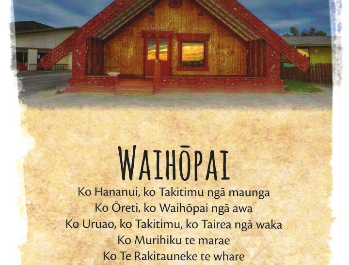
Te Rūnanga o Waihōpai is based in Southland with Murihiku Marae situated in Invercargill.

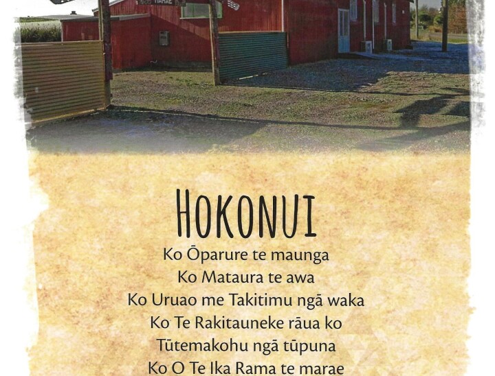
The wharekai, Hine o te Iwi, was the first building on the site when it opened in June 1983. The wharenui, Te Rakitauneke, opened in February 1990.

The takiwā centres on Waihōpai and extends northwards to Te Matau sharing an interest in the lakes and mountains to the western coast with other Murihiku Rūnanga and those located from Waihemo southwards.

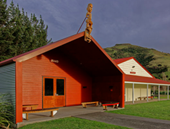
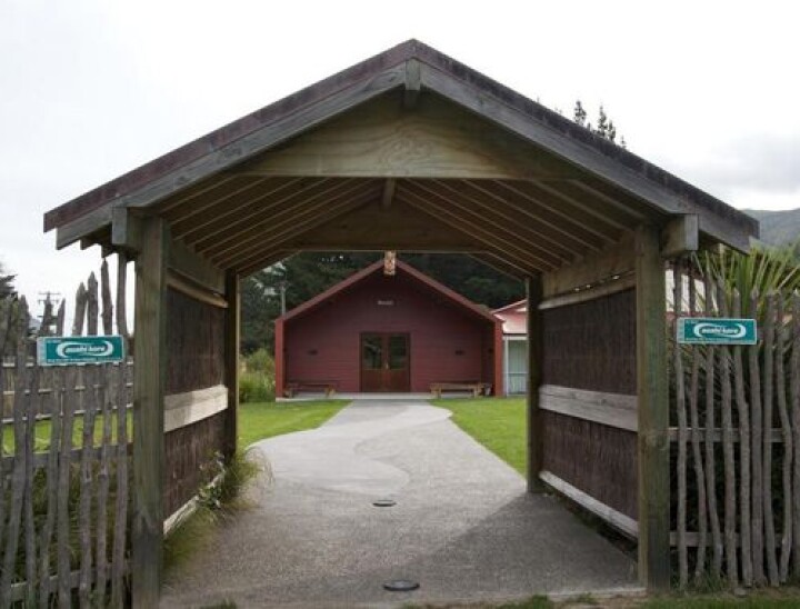
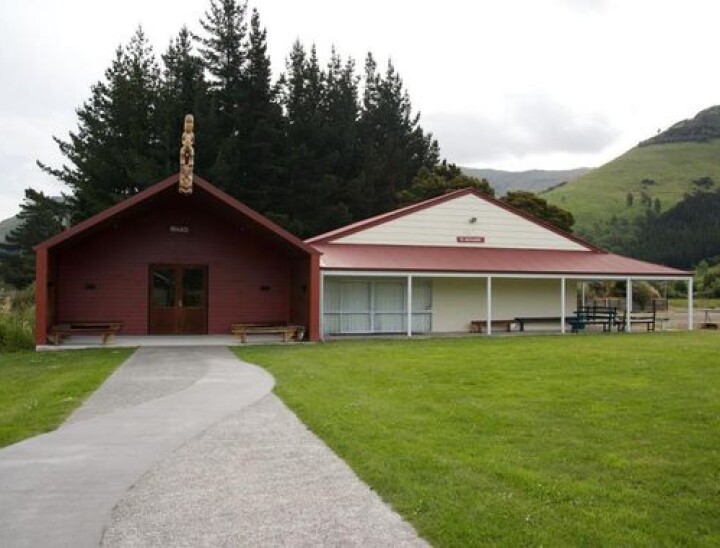
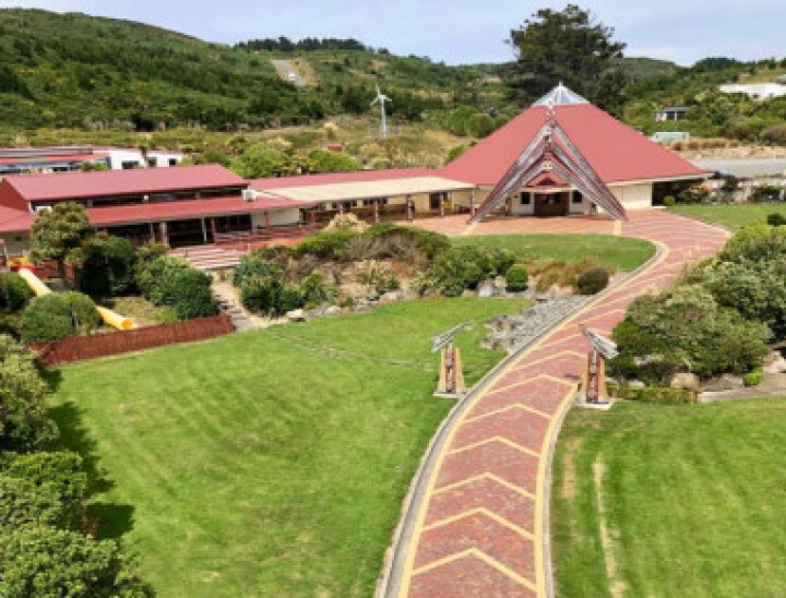
Murihiku Marae is a traditionally carved Maori Marae, and is the only traditionally carved Maori Marae in Southland NZ.

The Murihiku Marae is used as a meeting place for iwi, a place of worship and somewhere people can visit and learn about Māori history.

People can be accommodated – the dining hall, named Hine-O-Te-Iwi (Lady of the People), seats approx 200, and has a good sized stage where shows and Kapa Haka can be performed; Te Rakitauneke, the Wharenui can comfortably sleep 80 adults.

The Murihiku Marae is managed by the Waihōpai Rūnaka Inc.

In June 2008 Murihiku marae in Invercargill celebrated 25 years since the opening of its first building – the wharekai – Hine o te Iwi. The marae was established for both local people and those who came south for work.

Te Rakitauneke

Kāti Māmoe chief, Te Rakitauneke, the name of the whare tipuna at Murihiku Marae flourished about 1650 he was caught by a Kāi-Tahu waka-ariki and supposedly killed, and they left him on the ground and went on to his pā, where they found him standing in the gateway and they were beaten.

That was the work of his atua or god named Matamata. When Rakitauneke died (continued my informant, who had received his information from Tare Wetere te Kahu, a descendant of Rakitauneke) his body was buried, in accordance with his dying instructions, in a cleft in the rock on the summit of the Bluff Hill, with his face to the rising sun, so that he could overlook Murihiku.

Hence the name of that hill is Motu-poua (motu = island, poua = an old man). When the narrator of this story was a boy, there were bones in a crack in the rocks, but he did not think they were Rakitauneke’s; but it was a tapu spot until the Pākehā leveled the top of the hill to build the pilot observatory. The famous Tū-te-makohu was a descendant of Te Rakitauneke.

Waihōpai Mihimihi

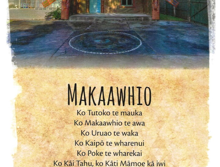
Ko Tākitimu te maunga
Ko Tākitimu te waka
Ko Waihōpai, ko Oreti, ko Waiau ngā awa
Ko Te Ara a Kiwa te moana
Ko Murihiku te whenua
Ko Murihiku te marae
Ko Hine o Te Iwi te wharekai
Ko Te Rakaitauneke te wharenui
Ko Kāti Irakehu te hapū
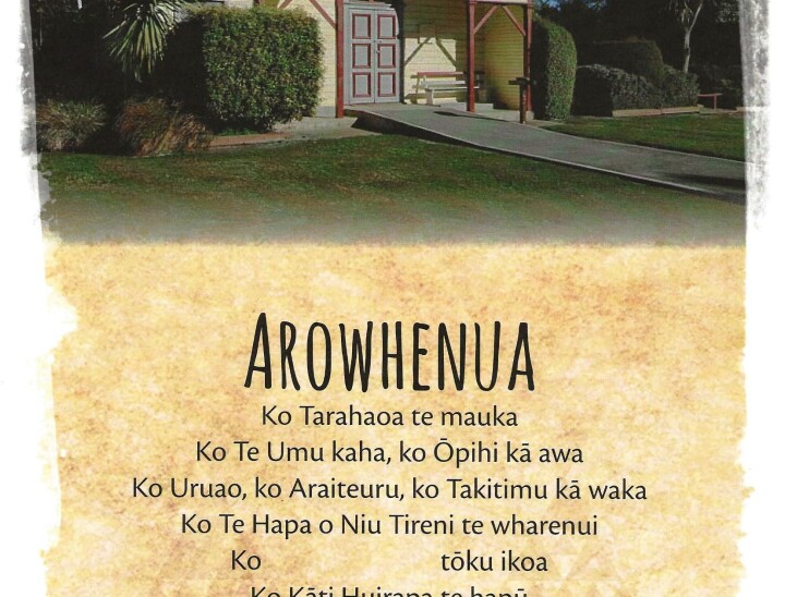
Ko Arowhenua te papa
Ko Pokene te Tangata
Ko Tahu Pōtiki te Rangatira

Our Present Kāi Tahu Rūnaku Affiliations - Awarua


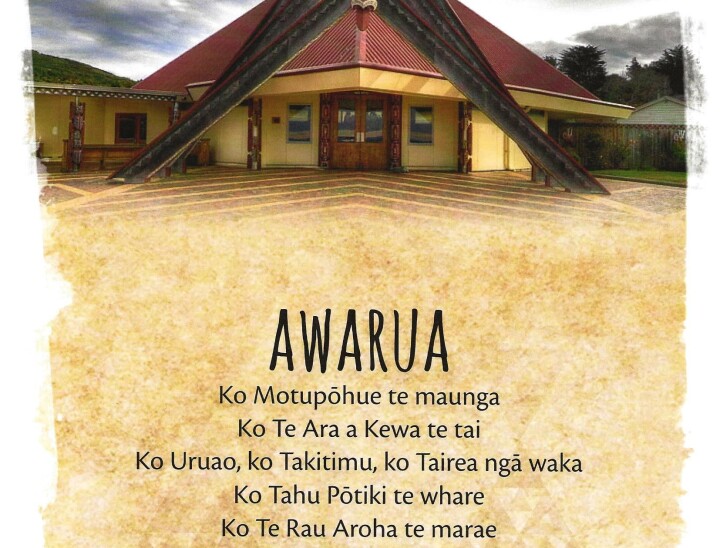
Te Rau Aroha Marae – Bluff

Tahu Pōtiki, the wharenui of Te Rau Aroha marae, takes its name from the tupuna (ancestor) of Ngāi Tahu.

It was designed by Cliff Whiting, and opened in February 2003 for the Awarua Rūnanga in Bluff.

This marae complex was named in remembrance of the bus that traveled throughout New Zealand during the First World War period, receiving donations for soldiers. Again the wharenui was the centre of the marae.

Named Tahu Pōtiki this wharenui also featured the bold colours and rich carvings expected from Whiting’s work.

Tahupōtiki and his Descendants

All the major descent lines of Ngāi Tahu stem from Tahupōtiki.

Awarua Wetlands

The Awarua wetlands comprise nearly 18,000 hectares, with estuarine areas, swamps, forest, tussock land and sand dunes in blocks of land between the New River estuary and Toetoe Bay. The area is home to migratory birds from the northern hemisphere, and bird’s native to New Zealand.

The wetlands include the Waituna scientific reserve, 3,500 hectares of peat land fronting onto the Waituna Lagoon. In 1976 it was designated a wetland of international importance.

The takiwā of Te Rūnanga o Awarua centres on Awarua and extends to the coasts and estuaries adjoining Waihōpai sharing an interest in the lakes and mountains between Whakatipu-Waitai and Tawhititarere with other Murihiku (Southland) Rūnaka and those located from Waihemo southwards.

Our Present Kāi Tahu Rūnaku Affiliations - Ōraka-Aparima


Ōraka / Colac – The Name

There are several theories as to how the area was called Colac. The most common theory is that it was named after a Māori chief called Kōrako which the English anglicised the name to Colac. The area has been home to the Māori people since at least the thirteenth century. Carbon datings (1270) have been taken from a nearby Argillite site which was used for the making of tools.

The area was rich in seafood, birds from the bush, fern roots, small streams from which eels, lamprey were caught. The beach was an ideal place to launch canoes to go down to the Tītī Islands (offshore Stewart Island) and collect the Tītī (sooty shearwater) commonly named the mutton bird.

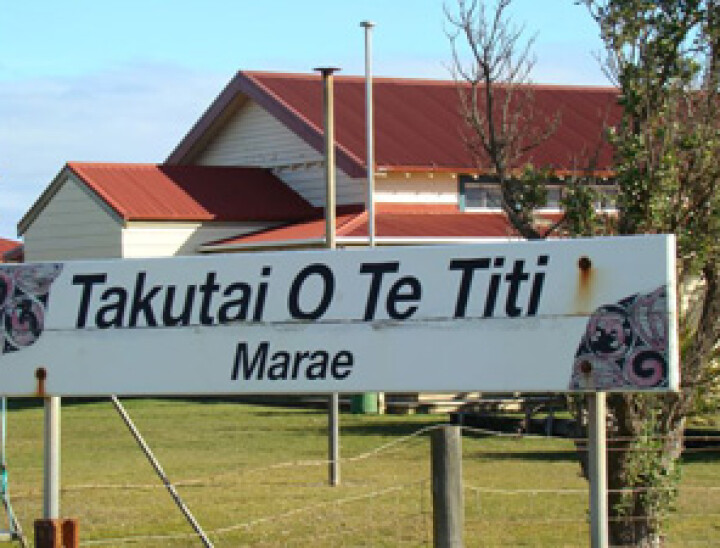
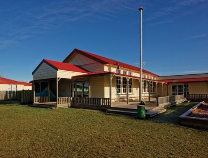
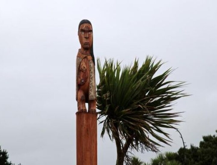
Today at Ōraka there are two Marae, Te Akau family Marae and Takutai o Te Tītī Marae. Although there are only three headstones in the cemetery, the cemetery is full.

A hall which was originally built in 1901 and is one of the largest community halls in the area. The Beach is very suitable for swimming and the east end of bay is very popular with surfers.
At the other end of the beach amongst the rocks at low-tide, it is possible to get yourself a feed of kuku.

Aparima / Riverton – 2006 population: 1,509

This district lies 38 km west of Invercargill, close to the sea on both sides of the estuary of the Aparima River (also known as the Jacobs River).

It is the oldest Pākehā settlement in Southland and Otago. Before the arrival of Europeans, it was home to a substantial Māori pā called Aparima, the inhabitants attracted by the harbour and ample seafood. In the mid-1830s, Captain John Howell established a whaling station there. He took a Māori woman of high rank as his wife and thereby acquired a lot of land. Today, a large memorial beside the Aparima River estuary commemorates Howell.

Farming has been the most important economic activity in the district, but there has also been timber and flax milling, gold mining and fishing. Chinese miners worked at Round Hill – about 300 were there in 1888. The port was active for commerce until a railway opened to Invercargill in 1879. Since then it has only been used for fishing and recreation.

Riverton has kept many colonial buildings, and cribs (small holiday homes) have been built on the west side of the estuary, and at the Rocks, on Howell Point. Pleasure craft and fishing boats ply the adjacent seas. Known as ‘Southland’s Riviera’, it is a mecca for artists and craftspeople. The Riverton Racing Club’s two-day Easter carnival is Southland’s best-known race meeting. Te Hīkoi, the Riverton heritage centre, opened in 2007.

Riverton Firsts


As Southland’s oldest Pākehā settlement, Riverton/Aparima won a number of firsts for Southland province: the first school was opened in 1837, and within a few years there were three, including one for Māori. The first hospital opened in 1861. Also in 1861, the first recorded horse race was held at a newly built track on the edge of town. And Invercargill engineer Herbert Pither achieved Southland’s first powered flight in his home-built plane, flying for a mile (1.6 km) along Riverton Beach on 5 July 1910.

Ōraka/Colac Bay

Ōraka/Colac Bay is 12 km west of Riverton/Aparima. The area has a long history of Māori settlement. European settlers arrived to mill timber in the 1850s, and the settlement boomed after the railway arrived in 1881. By 1900, the township contained some 2,000 inhabitants, and a post office, hall, school, blacksmiths, various shops, three hotels and even a sail maker. Nearby were the Chinese gold diggings at Round Hill.

Today there are sheep, deer and cattle farms, and it is a popular holiday resort with a tavern, cafeteria–bar, shop, camping ground and many holiday homes. Also cited there is the Takutai o Te Tītī marae of the Ōraka-Aparima rūnanga of Ngāi Tahu. The local surf beach is the most popular in Southland.

Orepuki

Orepuki is a farming centre 30 km west of Riverton/Aparima, on the eastern side of Te Waewae Bay. The name is a corruption of Aropaki (‘bright expanse’). The area is said to have been named by a group of Ngāi Tahu people as they emerged from the dense forest of Pahia Bush Hill and saw the bay for the first time.

The discovery of coal and shale in 1879 put Orepuki on the map. Shale was extracted in huge amounts by the London-based New Zealand Coal and Oil Company. A mine was built, and extraction and processing works operated between 1899 and the beginning of 1903. The workers who stayed turned their hand to sawmilling, but this ended in the 1950s.

Thornbury

From 1880 Thornbury was an important junction, at which rail lines from Invercargill to Riverton and to Nightcaps separated. Its former dairy factory is now a tannery for slink-skins (baby lambskins), which are sent from all over New Zealand.

Aparima River

Formerly known as Jacobs River, this 104-km river rises in the hills between Mossburn and Ōhai, and flows into the sea through a large estuary at Riverton (still named for Jacobs River). It is Southland’s whitebait river. Fisher folk in their hundreds line the river upstream from Riverton during the season, seeking the tiny, tasty fish. Fishermen also catch brown and rainbow trout, flounder and mullet in the estuary.

The takiwa of Te Rūnaka o Ōraka Aparima centres on Ōraka and extends from Waimatukuarima to Tawhititarere sharing an interest in the lakes and mountains from Whakatipu-Waitai to Tawhititarere with other Murihiku Rūnaka and those located from Waihemo southwards.

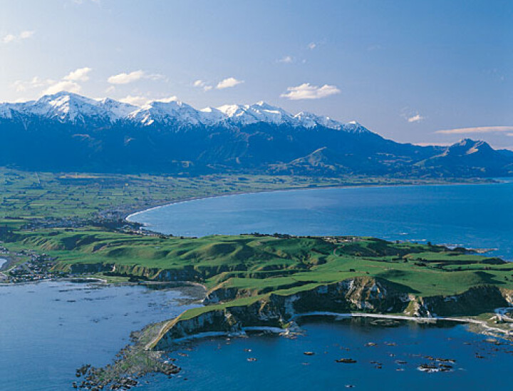
Our Present Kāi Tahu Rūnaku Affiliations - Kaikōura


Tēnā koutou katoa, e ngā uri o Kurī, nei rā te mihi atu ki a koutou i runga tonu nei i ngā āhuatanga o te tika me te pono o tēnei kaupapa manaaki taonga uta ki tai.

Mā pango, mā whero ka oti ai te mahi! Ka ora ai te iwi!

Ko Tapuae-o-Uenuku kei runga hei titireia mō te iwi, ko Waiau Toa kei raro i hono ai ki tōna hoa ki te hauraro ko Waiau Uwha.

Ko Te Tai o Marokura te moana i ū mai ai a Tūteurutira kia tau mai ki tō Hineroko whenua i raro i Te Whata Kai a Rokohouia. Ko tōna utanga he tāngata, arā ko ngā Tātare o Tānemoehau.

Ā, heke tātai mai ki tēnei ao. Mā tātou anō ngā awa me ngā awaawa, me ngā hiwi, me ngā toropuke, me ngā maunga, me ngā awanunui kei runga i a Te Ahi Kaikōura a Tama ki te Rangi whenua e tiaki, e atawhai.

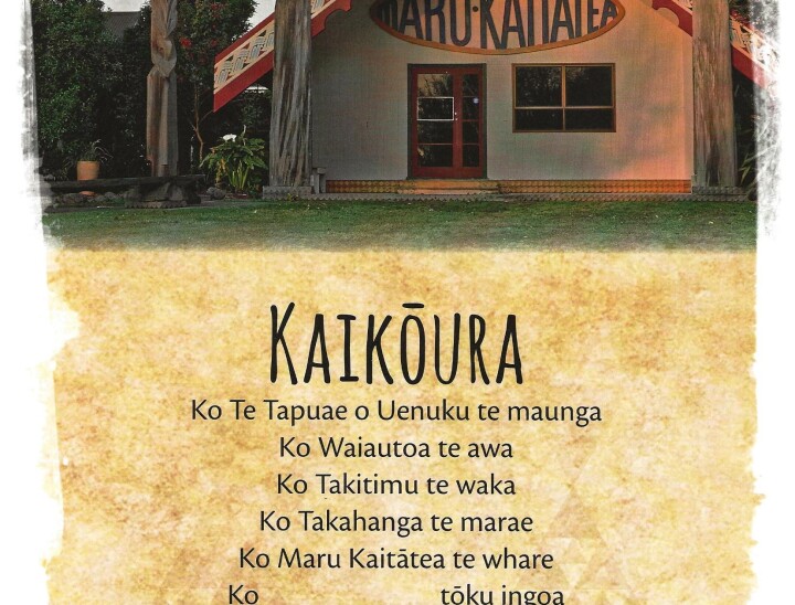
Ko Takahanga me Mangāmāunu ngā marae,

Ko Marukaitātea me Hōhepa ngā whare tīpuna,

Ko Ngāti Kurī me Ngā Uri o Mangāmāunu ngā tāngata,

Ko Waitaha, Kāti Mamoe, Ngāti Kurī me Ngāi Tahu ngā iwi,

Ko Te Rūnanga o Kaikōura tēnei.

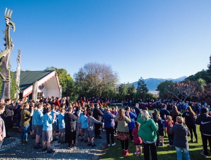
Takahanga Marae and Mangāmāunu Marae are the standing places for Ngāti Kurī.

Te Rūnanga o Kaikōura office is based at Takahanga Marae which is located on the original site of the ancient Takahanga Pā overlooking the Kaikōura township. The marae buildings and grounds are tapu and the mana associated with them requires the utmost respect. The wharenui stands on the exact site of the original wharenui which stood some 200 years previous. The original marae was occupied by Kāti Mamoe some 450 years previous.

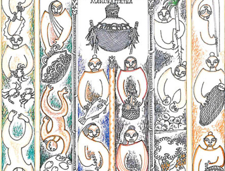
The current marae buildings were built in the mid 1980’s with the wharenui officially opening in January of 1992. Marukaitātea is the name of the wharenui, Marukaitātea is our tipuna, brother of Mako Hākirikiri and the son of Pūrahonui, they led Ngāti Kurī south in the migration to Te Waipounamu from the Wairārapa.

Pūrahonui was killed during the migration and Marukaitātea took his father’s place as chief, eventually settling here and claiming, manawhenua and manamoana after being challenged to eat from the sacred pōhā “Te Pōhā o Tohu Raumati” (kelp bag) containing the first and choicest fruits of the season. Being tapu these fruits were for those chiefs only of high rank. It was announced that whomever ate from the pōhā and survived could claim manawhenua. Our wharekai holds this pōhā name to this day.

The marae has traditionally been, and continues to be, the place where Ngāti Kurī, as tāngata whenua, gather to kōrero and dialogue with others.

Te Rūnanga o Kaikōura (“TROK”) is the modern-day representative of the hapū Ngāti Kurī – the tribal council for the hapū of Ngāti Kurī.

TROK Inc. was registered under the Incorporated Societies Act 1908 on the 3rd of December 2001.

All those that can whakapapa to Marukaitātea can affiliate to the Rūnanga.

TROK is one of 18 Papatipu Rūnanga as identified in the First Schedule of the Te Rūnanga o Ngāi Tahu Act 1996. Te Rūnanga o Ngāi Tahu (“TRONT”) represents the tribal collective of Ngāi Tahu whānui and was established by the Te Rūnanga o Ngāi Tahu Act 1996 to give legal identity to the tribe.

TROK’s takiwā stretches from Te Parinui o Whiti (White Cliffs South of Blenheim) to the Hurunui River and South West of the Main Divide.

Kaikōura Whakatau signed the Treaty of Waitangi with the crown on the 29th of March 1859. As his descendants we have an inherited responsibility to uphold the commitment of a Treaty partner.

The full name of Kaikōura is Te Ahi Kaikōura a Tama ki Te Rangi, Tama ki Te Rangi was an earlier ancestor and it is translated as the place where Tama ki Te Rangi cooked crayfish.

The Rūnanga meets every second Sunday of the month from February to November to discuss all matters pertaining to the Rūnanga.

Whakapapa Ngāti Raukawa / Ngāti Huia

He Kupu Tuku Iho: Oral History

Nā Uncle Hīrama Tamihana ki a Korey Gibson

Tēnā koutou Korey, the written presentation of Ngāti Toa by Kāhu Ropata which has been endorsed by Tā Matiu Te Rei, kaumātua rangatira o Ngāti Toa, tells us multitudes of messages, which can be said to be an assumption but certainly an apt way of displaying Ngāti Toa's acknowledgement of us Ngāti Huia and our tīpuna.

Especially the descendants of Parekohatu's brother Huia tua rua and the significance of his sons and daughters association with Te Rauparaha and Waitohi.

It was told to me by Kuia Roka Wirikake Mrs. Stewart that Huia (the second) took his sister to Ngāti Toa in her betroth to Werawera, Te Rauparaha's matua tāne. Why him? because he was the warrior, not like his tuakana, Tuwhakahewa, who was the tohunga.

Te Manea was too young at the time. As protector, his affection for his sister grew strong as he was aware she was not the first wife but the second, not a position relished, so he, his sons, and daughters kept vigil by interacting between the families.

Waitohi spent long periods with her Huia tua rua whanau.

When Waikato aired their distaste for Te Rauparaha, the Ngāti Toa Huia tua rua family responded by joining Te Rauparaha's sister Waitohi to protect her. They knew Te Rauparaha and Te Rangihaeata would fight, but their tuahine would be vulnerable.

The korowai of protection they, the descendants of Huia (the 2nd), had was that Weruweru -  Huia (the 2nd's wife), and their mother was a descendant of the Waikato chief Te Rauangaanga.

Further proof of that is that she named her daughter's grandson Te Rauanganga, who later had a son he named Nepia Te Rauangaanga.  Hence, if Waikato, Maniapoto, Haua, the rest of Waikato allies, had attacked and succeeded in defeating Ngāti Toa and their allies Huia tua rua descendants because of their whakapapa, they would have pleaded to spare Waitohi's life.

The story continues: Weruweru and Huia (the 2nd's) firstborn, was named after his father, and the second son was named after Kuia Weruweru - Te Humu o Tainui (in Pākehā: the hip bone of Tainui), His son Manahi Te Humu was the one who said we would not have come if Te Rauparaha had called; we came to protect Waitohi.

The story has not finished yet. We, my whānau descend from the eldest son and daughter of Huia (the 2nd), and Kāhu Ropata and his Ropata whānau at Kātihiku descend from Te Humu o Tainui, which is their Ngāti Huia side.

This is one of the main reasons I know I had the right to name our moko Waitohi Korey, Waitohi has always been special too my whānau.

Whakapapa Ngāti Tama

Ngāti Tama: Who We Are


A Historical Timeline

1830–1840: By the 1830s, Ngāti Tama had established settlements in at least four regions: Taranaki, Poneke, Te Tau Ihu o te waka a Māui, and Wharekauri.

1860s: Following the refusal by Wiremu Kīngi Rangitāke to sell the Pekapeka lands to the Crown, the Crown declared a state of martial law in Taranaki. The Crown built two military redoubts on Ngāti Tama ancestral land during these campaigns at Pukearuhe and Wai-iti. Both were built on wāhi tapu.

1865: Unable to acquire the land by force, the Crown took it by legislation. The confiscation of 27,400 hectares of land in Ngāti Tama Rohe was taken both from people who had fought against the Crown and from those who had not.

1866: Compensation courts were set up to identify "non-rebels" and to make awards of land to them.

1882: The West Coast Commission recommended the return of a small amount of land to Ngāti Tama, but by this time, the Crown had awarded almost all of the productive land in Ngāti Tama rohe to military settlers. Ngāti Tama were left with insufficient agricultural land for their needs. When Ngāti Tama supported the Parihaka campaign of peaceful resistance, they also suffered at the hands of the Crown.

1882: The Native Land Court ruled against Ngāti Tama in favour of Ngāti Maniapoto on two large land blocks north of the confiscation line.

1927: A Royal Commission of Enquiry was established to assess whether the confiscation of lands in 1865 was excessive. The Commission found that Taranaki Māori “ought not to have been punished by confiscation of any of the lands.”

1944: The Crown passed the Taranaki Lands Claim Settlement Act

1955: Without consultation with the iwi, an annual payment to the Taranaki Māori Trust Board of five thousand pounds was granted and purported to settle land claims in Taranaki forever.


Pēpeha: Tribal Proverb / Saying


Titoki ki runga, Mōkau ki raro! – Titoki above, Mōkau below!

(a reflection regarding our tribal boundaries: Titoki to the south and Mōkau to the north)


A Brief History

Ngāti Tama people migrated south in the 1820s in search of better opportunities (e.g., trade), to ensure their safety (e.g., there was the ongoing threat from musket-carrying Tainui war parties), and to establish close whakapapa and historic ties with Ngāti Toa (the main migrant group heading south to Te Whangānui-a-Tara, now Wellington). Ngāti Tama’s paramount chief, Te Puoho, was in charge of leading the expedition south, along with other chiefs, e.g., Te Kaeaea.

While Ngāti Tama was one of the first Taranaki iwi to arrive in Wellington in the 1820s, other Iwi, hapū, and whānau joined the migration from Taranaki, e.g., Ngāti Mutunga and Te Atiawa. People from these three iwi share the same heritage dating back to the Tokomaru waka. The central and southern Taranaki tribes, including Whanganui, also participated in the journey south.

The evidence suggests that Ngāti Tama arrived in Whangānui-a-Tara in a series of migrations from Taranaki (along with Te Atiawa, and led by Ngāti Toa) in 1822, participating in a process of invasion and conquest and occupation of the environs of Wellington by 1824. They encountered the Iwi who were already settled in Te Whangānui-a-Tara, including Ngāi Tara, Ngāti Ira, and Ngāti Kahungunu.

While Ngāti Toa, and the Taranaki iwi, hapu, and whanau shared intersecting rights throughout the environs of Wellington, Ngāti Tama maintained a separate and distinct identity in various places in Wellington. Ngāti Tama places of residence on the harbour included Kaiwharawhara, Pakuao and Raurimu from the first arrival in 1824, and Tiakiwai (Thorndon) after the departure of Ngāti Mutunga (in 1835).

Ngāti Tama settlements were established at Ōhāriu, Mākara, Ōhaua, and Ōterongo on the western coast; and Komangarautawhiri further north. Ngāti Tama also had summer fishing kāinga at Ōkiwi and Mukamuka (Palliser Bay).

The rights and customary interests of Ngāti Tama included all interests and all rights in Te Whangānui-a-Tara and the lands and resources of those places, in particular westward to the coast.

Ngāti Tama were joint tangata whenua, and had tino rangatiratanga, mana whenua and tangata whenua status over those lands in accordance with traditional Māori lore and custom. They exerted such status by their mana, rangatiratanga, by creating relations between groups, or by physical use, cultivation, and occupation.

Ngāti Tama maintained a separate and distinct identity in Wellington and enjoyed occupation, fishing, birding, and cultivation rights there. Ngāti Tama also set up a functioning organisational structure, including hapū and whānau units, with associated kāinga, marae, wāhi tapu, etc.

Despite the pressures of competing interests among the iwi of Wellington, initially, a thriving economy developed that was largely based on servicing visiting ships in particular. However, some people had lost their lives on the journey south (e.g., Te Taku). In November 1835, after a series of beachfront hui that discussed the possible invasion of Samoa and Norfolk Island, many took part in the invasion by sea of the Chatham Islands, which were closer. T

Together with Ngāti Mutunga, they captured the mate of The Lord Rodney and threatened to kill him unless they were taken to the Chatham Islands. After they reached the islands, the tribes took part in a slaughter of about 300 Moriori, raping many women, enslaving the survivors, and destroying the Moriori economy and way of life. Some returned home to Taranaki.

In 1835, 24 generations after the Moriori chief Nunuku had forbidden war, Moriori welcomed about 900 people from two Māori tribes, Ngāti Mutunga and Ngāti Tama. Originally from Taranaki on New Zealand’s North Island, they had voyaged from Wellington on an overcrowded European vessel, the Rodney. They arrived severely weakened, but were nursed back to health by their Moriori hosts. However, they soon revealed hostile intentions and embarked on a reign of terror.

Stunned, the Moriori called a council of 1,000 men at Te Awapātiki to debate their response. The younger men were keen to repel the invaders and argued that although they had not fought for many centuries, they outnumbered the newcomers two to one and were a strong people. But the elders argued that Nunuku’s Law was a sacred covenant with their gods and could not be broken. The consequences for Moriori were devastating.

Although the total number of Moriori first slaughtered was said to be around 300, hundreds more were enslaved by the invading tribes and later died. Some were killed by their captors. Others, horrified by the desecration of their beliefs, died of kongenge or despair.

According to records made by elders, 1,561 Moriori died between 1835 and 1863, when they were released from slavery. Many succumbed to diseases introduced by Europeans, but large numbers died at the hands of Ngāti Mutunga and Ngāti Tama. In 1862, only 101 remained. When the last known full-blooded Moriori died in 1933, many thought this marked the extinction of a race.

In the late 1830s, the New Zealand Company brought into Te Whangānui-a-Tara boatloads of European colonisers in search of a place to settle. The effects on the Ngāti Tama of the European settlers, who competed for resources, was to prove disastrous as the new arrivals sought Māori land.

The Port Nicholson Deed was a land sale transaction between the New Zealand Company and chiefs in the Hutt Valley, with Ngāti Tama Chief Te Kaeaea participating. The New Zealand Company thought they had purchased land from Te Kaeaea, but they had only been given anchorage and port rights to Wellington Harbour.

The Crown set up the Spain Commission to enquire into the Wellington land sales. Spain came to adopt an attitude towards Ngāti Tama claims, which ultimately came to seriously prejudice their interests because of Ngāti Tama’s actions in occupying land in the Hutt. While Spain noted the numerous faults inherent in the land sales, his findings incorrectly assumed that Te Kaeaea’s participation in the Port Nicholson transaction was equal to complete comprehension of and support for the sale of Ngāti Tama land. Despite the protestations from the Ngāti Tama people, the Crown assisted the settlers by making grants of Ngāti Tama lands. The impact of Crown action in Te Whangānui-a-Tara was fatal; Ngāti Tama lost the land they had conquered in 1822.

In 1844, Governor Fitzroy adopted a policy of compensating Ngāti Tama. There was no consultation, and compensation proceeded in a summary fashion. Ngāti Tama living in Kaiwharawhara received their share of the compensation under protest, and Ngāti Tama living in Ōhāriu missed out on any payment at all.

In 1847, McCleverty concluded a series of agreements with Ngāti Tama to finally settle the reserves issue. In total, the 200 Ngāti Tama received 2600 acres of reserves. These reserves (about 13 acres per person) were set aside as compensation. Whatever reserves had been awarded were inadequate for their needs. The reserves were also unsuitable for cultivation, and crops had been integral to their survival.

By 1842, the Ngāti Tama people were forcibly removed from their lands by Crown-assisted settler occupation. They sought refuge by squatting on land in the Hutt Valley, where the land was more productive than the reserve land they had been awarded. But this was short-lived; the Hutt occupation ended in February 1846, when Governor Grey evicted Ngāti Tama under the threat of military intervention. Ngāti Tama’s cultivated areas, their sole means of survival, were plundered. The Ngāti Tama chief, Te Kaeaea was exiled in Auckland. The remaining Ngāti Tama people had to seek sanctuary with other iwi and hapū in Wellington or elsewhere, suffered high levels of sickness and mortality, and had to sell reserve land out of necessity. When the Crown had finished its land acquisition programme, Ngāti Tama had virtually no land left. By the 1870s, Ngāti Tama had largely moved from the harbour rim and had been evicted.

The impact on Ngāti Tama was significant. The Ngāti Tama people had been scattered by the invasion of the Waikato tribes during the musket wars of the 1820s. Many then left Wellington, which they had invaded and conquered, to take part in the seaborne invasion of the Chatham Islands. Some individuals survived, many in whānau groupings, living with other iwi and hapū. But there was an absence of a contemporary, organised, formal Ngāti Tama iwi presence in Wellington. Ngāti Tama’s land base and visible identity in Wellington as a local iwi was lost.

In the absence of an organised entity representing Ngāti Tama in Wellington, other iwi such as Ngāti Toa and Te Atiawa took responsibility for looking after Ngāti Tama interests. In particular, the Wellington Tenths Trust has directly represented the interests of its beneficiaries, namely those individuals and their descendants who were named as owners of Ngāti Tama reserves in the Wellington region in the 19th century. 


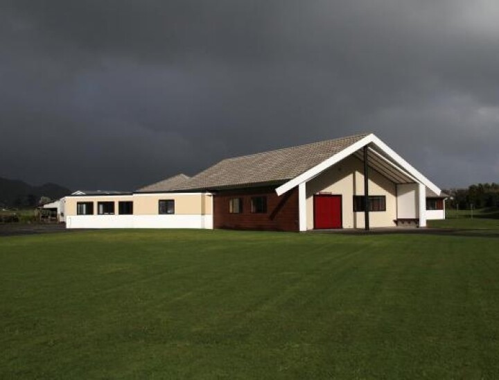
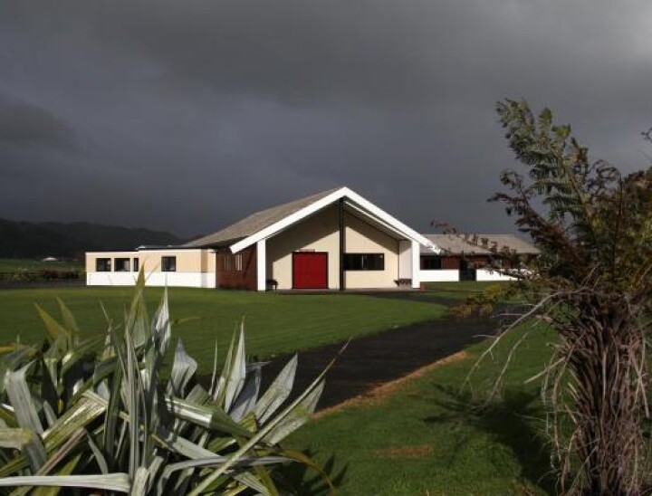
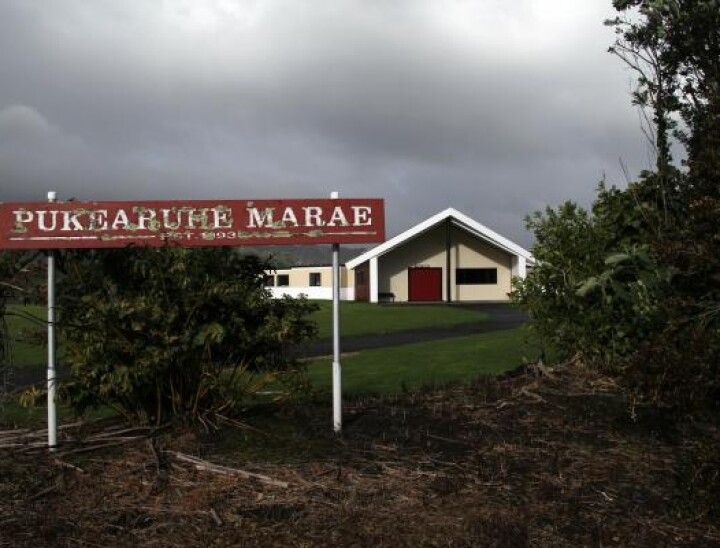
Pukearuhe Marae

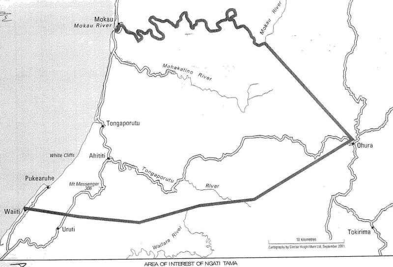
Pukearuhe marae is located along the west coast off SH3, roughly 45 km north of New Plymouth. The marae connects ancestrally to the waka Tokomaru. It takes its name from the nearby pā at the southern end of Parininihi (the White Cliffs), which has guarded the entrance to Taranaki for many centuries. (19 Waikaramarama Rd – Pukearuhe Road Waiiti)

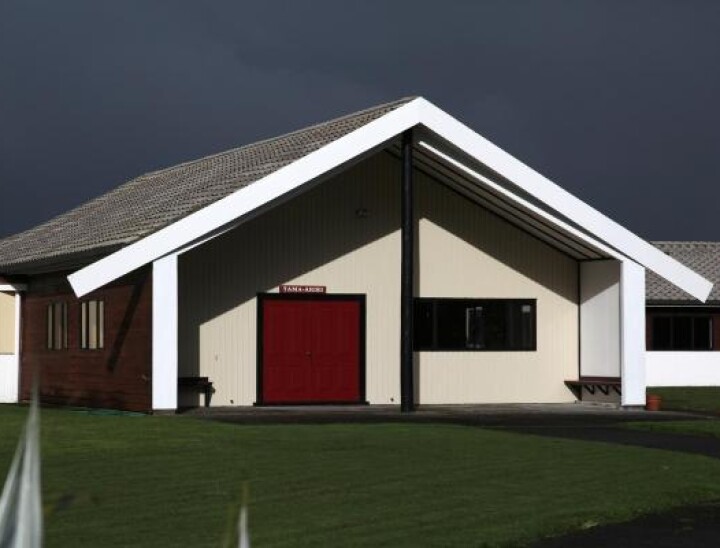
Whare: Tama Ariki

Battalion: D Company, Ngāti Walkabout

Iwi / Rūnanga: Ngāti Tama

Rohe: Te Tai Hauāuru


Ngāti Tama Territory Map


Whakapapa Tauiwi (Pākehā)

Australian Ancestry

William Thomas Junior was born in Sydney, Australia, in 1811.

His father was William Thomas Senior, and his mother was Mary Thomas (nee Mason). Both moved from England to Sydney in the early 1800’s.

William Thomas Senior was a highwayman who was charged on July 28th, 1800, with robbery and assault at Hertford in June of the same year.

He was sentenced to death, but this was commuted to transportation for life.

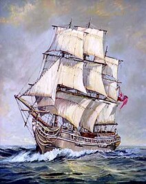
He was shipped to Australia with 138 other male convicts in 1802 on board the ship Coromandel.

The Coromandel arrived at Portsmouth on January 12, 1802, and departed from Spithead in company with the Perseus bound for Port Jackson on February 12, 1802. She came direct, the first convict ship to do so, and arrived in Port Jackson on 13 June 13, 1802

Mary Mason, his mother, was tried for larceny in Bristol on April 2, 1803, and then sent to Sydney on the ship the Experiment in 1804.

You can find out the history of the Coromandel ship here.


English Ancestry


Norweigan Ancestry

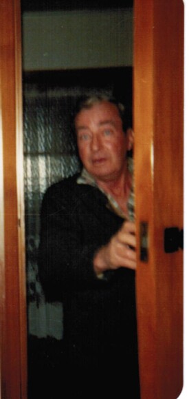
Leonard Norman Hansen, "Norm"
"Grandfather"

Hansen or Hanssen (Danish pronunciation: [ˈhænsn̩]) is a Scandinavian patronymic surname, meaning son of Hans. As of 2008, it is the third most common surname in Denmark, shared by 4.3% of the population.[1] As of 2000, Hansen is the single most common surname in Norway, not counting spelling variations such as Hanssen, which are also quite common.[2] In the Faroe Islands Hansen is the second most common surname, while in the North German federal states of Schleswig-Holstein and Hamburg Hansen is the third and fifth most common surname, respectively.[3] In Sweden the parallel form is Hansson. The frequent occurrences of Hansen as a surname outside Denmark,[4] Norway and Schleswig-Holstein is due to immigration, though Nordic immigrants to English-speaking countries often anglicised their names to Hanson in order to accommodate English orthographic rules.

Hansen is a common Danish surname derived from the name of an ancestor, ‘the son of Hans’.

Note: Danish surnames tended to be patronymic, a name derived from the personal name of the father or from the father’s occupation.

This means the surnames tend to change with each generation and with the gender of the child (‘sen’ for son of, ‘datter’ for daughter of).

This means that someone is not likely to be related to someone else from Denmark with the same surname. This surname system gradually ended in the mid-1800s (depending on the family).


Whakapapa: Grandfather Norman Leonard Hansen


Christine Isabella Mason (Mother) = William Hansen (Father)

Children (7):

Muriel (F)

Gladys (F)

Edie (F)

William “Bill” (M) B.? or D. via suicide (hanging) aged? in 1961 at Gasson St, Sydenham, Christchurch

Aubrey (M): DEATH CERT ORDERED

Arthur (M)

* Leonard Norman Hansen (M) June 4th, 1911 / D. via heart attack, aged 71 on April 4th, 1983 at 39 Carisbrooke St, Aranui, Christchurch

Wife 1: Catherine Victoria Cooke (Spinster: “an unmarried woman, typically an older woman beyond the usual age for marriage.) They married on March 8, 1939, and lived together at 67 Madras Street, Sydenham, Christchurch.

Wife 2: Hinewai Lorraine Thomas


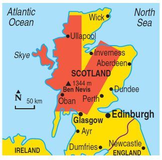
Scottish Ancestry